Ryōtsu, Niigata
Ryōtsu (両津市, Ryōtsu-shi) was a city located in Sado Island, Niigata Prefecture, Japan.
Ryōtsu 両津市 | |
|---|---|
Former municipality | |
Ryotsu Port | |
 Flag  Emblem | |
| Country | Japan |
| Region | Hokuriku |
| Prefecture | Niigata Prefecture |
| District | Sado District |
| Merged | March 1, 2004 (now part of Sado) |
| Area | |
| • Total | 233.37 km2 (90.10 sq mi) |
| Population (2003) | |
| • Total | 16,710 |
| Time zone | UTC+9 (JST) |

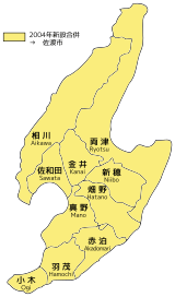
10 subdivisions (former municipalities) in the Sado City. Ryotsu is located on the east of the island.
On March 1, 2004, Ryōtsu and the other 9 municipalities in the island were merged to create the city of Sado. Since then, Ryōtsu has been one of the 10 subdivisions of Sado City.
As of 2003, the city had an estimated population of 16,710 and a density of 71.60 persons per km². The total area was 233.37 km².
History
The city was founded on November 3, 1954.
On March 1, 2004, Ryōtsu, along with the rest of Sado Island (the towns of Aikawa, Kanai, Sawata, Hatano, Mano, Hamochi and Ogi, and the villages of Niibo and Akadomari (all from Sado District)), was merged to create the city of Sado.
Transportation
Bus
- Niigata Kotsu Sado
Highway
Sea
- Ryōtsu Port
- Sado Kisen Terminal
- Car ferry and Jetfoil services to/from Niigata Port
- Sado Kisen Terminal
Local attractions
- Lake Kamo
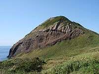
- Onogame
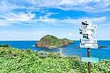
- Futatsugame
 Onogame
 Futatsugame
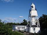
 Himezaki Lighthouse
gollark: Always Blame the User™!
gollark: I think the loading screen textures are missing, remove custommainmenu maybe.
gollark: 9.9.9.9 returns a different IP, which also checks out, though.
gollark: Anyway, for me, 1.1.1.1 and 8.8.8.8 do return different IPs for google.com, but they both whoisise as google.
gollark: How can people even use WHOIS with the whole GDPR nonsense surrounding that?
See also
External links
- Sado Tourism Association (in English)
- Sado Steam Ship (in English)
- Sado Geopark (in English)
This article is issued from Wikipedia. The text is licensed under Creative Commons - Attribution - Sharealike. Additional terms may apply for the media files.