Rožaje
Rožaje (Cyrillic: Рожаје, Albanian: Rozhajë, pronounced [rɔ̂ʒajɛ]), is a town in northeastern Montenegro. As of 2011, the city has a population of 9,567 inhabitants.
Rožaje Рожаје Rozhajë | |
|---|---|
Town and municipality | |
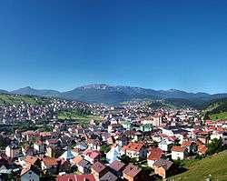
 View of Rožaje | |
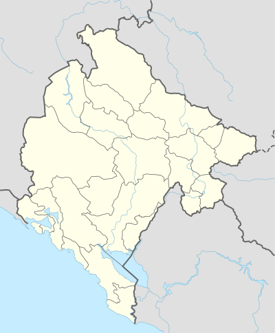
 Rožaje Location of Rožaje in Montenegro | |
| Coordinates: 42.84°N 20.16°E | |
| Country | |
| Municipality | Rožaje Municipality |
| Settlements | 66 |
| Government | |
| • Mayor | Semir Avdić |
| • Ruling party | Bosniak Party |
| Area | |
| • Town and municipality | 432 km2 (167 sq mi) |
| Population (2011[1]) | |
| • Density | 53/km2 (140/sq mi) |
| • Urban | 9,422 |
| • Rural | 13,542 |
| • Municipality | 22,964 |
| Demonym(s) | Rožajci |
| Time zone | UTC+1 (CET) |
| • Summer (DST) | UTC+2 (CEST) |
| Postal code | 84310 |
| Area code | +382 51 |
| ISO 3166-2 code | ME-17 |
| Car plates | RO |
| Climate | Cfb |
| Website | www |
Surrounded by hills to its west and mountains to its east (notably Mount Hajla), it is the source of the river Ibar, which gives its name to the local sports clubs FK Ibar, KK Ibar and OK Ibar. Rožaje is the centre of the Rožaje Municipality within the 24 municipalities of Montenegro.
History
Rožaje was first settled in antiquity by Illyrians. Later, during the migration of the Slavs, Slavs settled in the area.[2] Rožaje was first mentioned in 1571 and 1585. The settlement surrounding the then fort was called Trgovište, which it was called until 1912.
In 1797 the Ganić kula, a defensive tower (much like the same towers build within the Caucasus region between Russia and Georgia), built from the Muslim side of the Kuči (Muslim members of the clan), as they supported Muslim authority and culture, was built. Nowadays, the tower is currently the town's museum.[3]
During the Ottoman Empire's reign over Montenegro, the Sultan Murat II Mosque was constructed in the city in the 1500s, which also contains the turbe of the sultan's body.
During World War I, the army of the Kingdom of Montenegro captured the city in 1912 from the Ottoman Empire, during the First Balkan War. It was officially ceded to Montenegro following the Treaty of London in 1913 that ended the war. After the war, Rožaje was one of the main cities that participated in the Plav rebellion (Plavska pobuna) of 1919, which fought against the inclusion of Sandzak in the Kingdom of Serbs, Croats and Slovenes. An estimated 700 Albanians were killed in Rožaje when the rebellion was quelled.[4]
During World War II, the city has seen conflict between the Yugoslav Partisans, the Chetniks, the Sandzak Muslim Militia, and the Albanian Vulnetari. Mullah Jakup Kardović, who would end up being a prominent commander of the Militia and would participate in the Battle for Novi Pazar, came from the village of Biševo, which is 4-5km away from the city.
In 1992, during the Yugoslav Wars, the Bosniaks of Foča who managed to escape the massacre that happened in the town were resettled in Rožaje.[5]
In 2018, a replica of the Sebilj in Sarajevo has been completed and is currently displayed in the town's main square.[6]
Rožaje annually celebrates its foundation day on September 30th.[7]
Population and demographics
Rožaje is the administrative centre of the Rožaje municipality, which has a total of 23,312 residents. The town of Rožaje itself has a population of 9,567 in 2011. Rožaje is also considered to be the centre for the Bosniak community of Montenegro. Bosniaks form the majority in both the town and the municipality itself.
Ethnic Albanians have been present within the city, as well as the outskirts, especially villages that are close to the border of Kosovo. They enjoy and support mutual relations with the Bosniaks and other ethnicities within the city and have also became an integral part of Rožaje's society. The current population of Albanians living in Rožaje rounds up to 1,158, forming 5% of the total population in 2011. The population of Rožaje from 1981 (as SR Montenegro) to 2011 (as the current republic) is as shown below:
- March 3, 1981 – 7,336
- March 3, 1991 – 8,828
- November 1, 2003 (as SCG) – 9,121
- July 1, 2011 – 9,567
Transport
Rožaje is situated on the main road connecting Montenegro with Kosovo, known as the Rožaje-Kula-Peć road (Kula being the border post between Montenegro and Kosovo on both sides). It also has a link with Novi Pazar in Central Serbia. The IB-22 Highway (otherwise known as the Ibarska magistrala) is the main regional road that connects Montenegro with Serbia. It is also connected to the rest of Montenegro by a two-laned highway via Berane, which is some 30 km (19 mi) in distance.
The nearest airport is the Pristina International Airport in Pristina, Kosovo which is 116 km (72 mi) away, compared to Podgorica Airport which is about 180 km (110 mi) away, and has regular flights to major European destinations annually.
Gallery
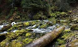
- Ibar river canyon

 Hajla near Rožaje
Sources
References
- Prvi rezultati popisa 2011. (PDF) (in Montenegrin), Monstat, 15 May 2011, p. 9
- "History of Rožaje". Retrieved 28 June 2013.
- Darren (Norm) Longley; Rough Guides (30 March 2009). The Rough Guide to Montenegro. Penguin. p. 156. ISBN 978-1-4053-8425-4. Retrieved 10 May 2012.
- Morrison 2018, p. 21.
- Human Rights Watch, 2006-Genocide, war crimes, and crimes against humanity: a topical digest of the case law of the International Criminal Tribunal for the former Yugoslavia
- "Simbol Sarajeva u Sandžaku: Nakon Pazara, Sjenice sebilj ukrašava i Rožaje FOTO/VIDEO". AKOS (in Bosnian). Retrieved 2019-01-31.
- "Skupstina Crne Gore". September 2019.
Bibliography
- Morrison, Kenneth (2018). Nationalism, Identity and Statehood in Post-Yugoslav Montenegro. Bloomsbury Publishing.CS1 maint: ref=harv (link)