Rosston, Arkansas
Rosston is a town in south-central Nevada County, Arkansas, United States. The population was 265 at the 2000 census. It is part of the Hope Micropolitan Statistical Area.
Rosston, Arkansas | |
|---|---|
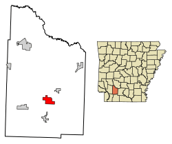 Location of Rosston in Nevada County, Arkansas. | |
| Coordinates: 33°35′19″N 93°17′11″W | |
| Country | United States |
| State | Arkansas |
| County | Nevada |
| Area | |
| • Total | 4.44 sq mi (11.51 km2) |
| • Land | 4.42 sq mi (11.45 km2) |
| • Water | 0.02 sq mi (0.06 km2) |
| Elevation | 387 ft (118 m) |
| Population (2010) | |
| • Total | 261 |
| • Estimate (2019)[2] | 237 |
| • Density | 53.61/sq mi (20.70/km2) |
| Time zone | UTC-6 (Central (CST)) |
| • Summer (DST) | UTC-5 (CDT) |
| ZIP code | 71858 |
| Area code(s) | 870 |
| FIPS code | 05-61040 |
| GNIS feature ID | 0054227 |
Geography
Rosston is located at 33°35′19″N 93°17′11″W (33.588495, -93.286457).[3]
According to the United States Census Bureau, the town has a total area of 11.6 km2 (4.5 mi2), of which 11.5 km2 (4.4 mi2) is land and 0.1 km2 (0.04 mi2) (0.45%) is water.
Demographics
| Historical population | |||
|---|---|---|---|
| Census | Pop. | %± | |
| 1880 | 57 | — | |
| 1980 | 274 | — | |
| 1990 | 262 | −4.4% | |
| 2000 | 265 | 1.1% | |
| 2010 | 261 | −1.5% | |
| Est. 2019 | 237 | [2] | −9.2% |
| U.S. Decennial Census[4] | |||
As of the census[5] of 2000, there were 265 people, 95 households, and 72 families residing in the town. The population density was 23.0/km2 (59.5/mi2). There were 118 housing units at an average density of 10.2/km2 (26.5/mi2). The racial makeup of the town was 41.89% White, 57.74% Black or African American, 0.38% from other races. 0.38% of the population were Hispanic or Latino of any race.
There were 95 households, out of which 42.1% had children under the age of 18 living with them, 54.7% were married couples living together, 15.8% had a female householder with no husband present, and 24.2% were non-families. 22.1% of all households were made up of individuals, and 12.6% had someone living alone who was 65 years of age or older. The average household size was 2.79 and the average family size was 3.28.
In the town, the population was spread out, with 31.7% under the age of 18, 9.4% from 18 to 24, 30.2% from 25 to 44, 15.1% from 45 to 64, and 13.6% who were 65 years of age or older. The median age was 31 years. For every 100 females, there were 103.8 males. For every 100 females age 18 and over, there were 92.6 males.
The median income for a household in the town was $27,500, and the median income for a family was $36,250. Males had a median income of $27,708 versus $18,750 for females. The per capita income for the town was $11,957. About 20.7% of families and 26.2% of the population were below the poverty line, including 28.6% of those under the age of eighteen and 32.5% of those 65 or over.
Infrastructure
Highways


Education
Public Schools
Public education for elementary and secondary school students is provided by the Nevada School District, which leads to graduation from Nevada High School. As of the 2014–2015 school year, the district encompasses 345.15 square miles (893.9 km2) of land, supports more than 400 students, and employs more than 80 educators and staff at its two schools and district offices
Nevada School District includes the following school facilities:
- Nevada Elementary School, serving kindergarten through grade 6.
- Nevada High School, serving grades 7 through 12.
Notable person
- Thomas Chipman McRae, United States House of Representatives (1885 to 1903), 26th Governor of Arkansas.[6]
See also
References
- "2019 U.S. Gazetteer Files". United States Census Bureau. Retrieved June 30, 2020.
- "Population and Housing Unit Estimates". United States Census Bureau. May 24, 2020. Retrieved May 27, 2020.
- "US Gazetteer files: 2010, 2000, and 1990". United States Census Bureau. 2011-02-12. Retrieved 2011-04-23.
- "Census of Population and Housing". Census.gov. Retrieved June 4, 2015.
- "U.S. Census website". United States Census Bureau. Retrieved 2008-01-31.
- "Thomas Chipman McRae (1851–1929)". Derek Allen Clements, The Central Arkansas Library System - EncyclopediaOfArkansas.net. February 5, 2016. Retrieved April 10, 2016.
External links
![]()
Municipalities and communities of Nevada County, Arkansas, United States | ||
|---|---|---|
| Cities | 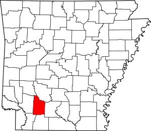 Map of Arkansas highlighting Nevada County | |
| Towns | ||
| CDP | ||
| Unincorporated communities | ||
| Footnotes | ‡This populated place also has portions in an adjacent county or counties | |