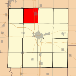
Rome Township, Jefferson County, Illinois
Rome Township is one of sixteen townships in Jefferson County, Illinois, USA. As of the 2010 census, its population was 1,669 and it contained 771 housing units.[2]
Rome Township | |
|---|---|
 Location in Jefferson County | |
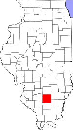
 Jefferson County's location in Illinois | |
| Coordinates: 38°26′N 88°59′W | |
| Country | United States |
| State | Illinois |
| County | Jefferson |
| Area | |
| • Total | 36.31 sq mi (94.0 km2) |
| • Land | 36.25 sq mi (93.9 km2) |
| • Water | 0.05 sq mi (0.1 km2) 0.14% |
| Elevation | 528 ft (161 m) |
| Population (2010) | |
| • Estimate (2016)[1] | 1,654 |
| • Density | 46/sq mi (18/km2) |
| Time zone | UTC-6 (CST) |
| • Summer (DST) | UTC-5 (CDT) |
| ZIP codes | 62830, 62864, 62889, 62893, 62898 |
| FIPS code | 17-081-65377 |
Geography
According to the 2010 census, the township has a total area of 36.31 square miles (94.0 km2), of which 36.25 square miles (93.9 km2) (or 99.83%) is land and 0.05 square miles (0.13 km2) (or 0.14%) is water.[2] The township is centered at 38°26'N 88°59'W (38.430, −88.976). It is traversed north-south by Interstate Route 57 and State Route 37.
Cities, towns, villages
Unincorporated towns
- Boyd at 38.414°N 89.013°W
(This list is based on USGS data and may include former settlements.)
Adjacent townships
- Raccoon Township, Marion County (north)
- Haines Township, Marion County (northeast)
- Field Township (east)
- Mt. Vernon Township (southeast)
- Shiloh Township (south)
- Casner Township (southwest)
- Grand Prairie Township (west)
- Centralia Township, Marion County (northwest)
Cemeteries
The township contains these seven cemeteries: Boyd, Boyd Farm, Ebenezer, Gilead, Jennings Farm, Little Grove and Pleasant Hill.
Major highways
Political districts
- Illinois' 19th congressional district
- State House District 107
- State Senate District 54
gollark: There's no rule against submitting my submission.
gollark: Although the regexy version (below) is better.
gollark: Now, *arguably* it might not have been entirely tactically optimal to publicly release it so early, but it was a cool idea so I had to share it early.
gollark: https://discord.com/channels/346530916832903169/802678225791746089/819994409528852490
gollark: You could submit my submission.
References
- "Rome Township, Jefferson County, Illinois". Geographic Names Information System. United States Geological Survey. Retrieved 2010-01-17.
- United States Census Bureau 2007 TIGER/Line Shapefiles
- United States National Atlas
- "Population and Housing Unit Estimates". Retrieved June 9, 2017.
- "Population, Housing Units, Area, and Density: 2010 - County -- County Subdivision and Place -- 2010 Census Summary File 1". United States Census. Archived from the original on 2020-02-12. Retrieved 2013-05-28.
- "Census of Population and Housing". Census.gov. Retrieved June 4, 2016.
External links
This article is issued from Wikipedia. The text is licensed under Creative Commons - Attribution - Sharealike. Additional terms may apply for the media files.