Rock River Township, Michigan
Rock River Township is a civil township of Alger County in the U.S. state of Michigan. The population was 1,212 at the 2010 census.[3]
Rock River Township, Michigan | |
|---|---|
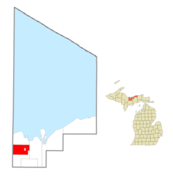
 Location within Alger County (red) and the administered village of Chatham (pink) | |
 Rock River Township Location within the state of Michigan | |
| Coordinates: 46°21′05″N 86°57′56″W | |
| Country | United States |
| State | Michigan |
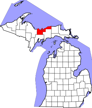
| County | Alger |
| Government | |
| • Supervisor | Teri Grout |
| • Clerk | Dawn Leppanen |
| Area | |
| • Total | 81.0 sq mi (209.8 km2) |
| • Land | 80.7 sq mi (209.1 km2) |
| • Water | 0.3 sq mi (0.7 km2) |
| Elevation | 988 ft (301 m) |
| Population (2010) | |
| • Total | 1,212 |
| • Density | 15.0/sq mi (5.8/km2) |
| Time zone | UTC-5 (Eastern (EST)) |
| • Summer (DST) | UTC-4 (EDT) |
| ZIP code(s) | |
| Area code(s) | 906 |
| FIPS code | 26-69160[1] |
| GNIS feature ID | 1626993[2] |
Communities
- Chatham is a village at the junction of M-67 and M-94.
- Eben Junction is an unincorporated community at 46°21′18″N 86°58′12″W.[4] The Eben Junction ZIP code 49825 provides P.O. box service for a portion of Rock River Township and an area of adjacent Onota Township.[5][6] It was a station at the junction of the Minneapolis, St. Paul and Sault Ste. Marie Railroad and the Munising Railway. A post office was established on August 1, 1908, with Emil Hoppe as the first postmaster of the Finnish settlement.[7]
- Rumely is an unincorporated community at 46°20′54″N 87°01′59″W.[8] It was named for Mr. Rumely, who settled here from Ohio about 1873. It was a station on the Munising Railway about 1890. A post office was established on September 24, 1906, with Cyrill Valind as its first postmaster. The office closed on March 31, 1943, and was reestablished on December 16, 1947. It closed on August 31, 1959, and is now a CPO of Eben Junction providing P.O. box service for ZIP code 49826.[6][7][9][10] The Post Office was located in the old Rumely Store, but closed in 2011 or 2012 when the store closed. The store reopened, under new ownership, in February 2015, but without any mail service.
- Slapneck is a place at 46°20′34″N 86°53′11″W.[11]
- Sundell is an unincorporated community at 46°20′50″N 87°04′47″W.[12] In 1908, Dorsey was a station on the Munising, Marquette and Southeastern Railway. The first postmaster, Selma Harsila, submitted her maiden name, Sundell (Swedish), as the name of the new post office.[7] The office operated from August 31, 1922 until August 25, 1967.[13] Dorsey is approximately a half mile to the west at 46°20′23″N 87°05′04″W.[14]
- Winters was a former post office in the township at 46°11′42″N 86°55′43″W. The settlement was named for John D. Winters, who was also the first postmaster. The post office first opened September 20, 1889 and closed August 15, 1923. It reopened from February 25, 1924, until June 15, 1928.[7][15]
Geography
According to the United States Census Bureau, the township has a total area of 81.0 square miles (209.8 km2), of which 80.7 square miles (209.1 km2) is land and 0.27 square miles (0.7 km2), or 0.31%, is water.[3]
Demographics
| Historical population | |||
|---|---|---|---|
| Census | Pop. | %± | |
| 1960 | 1,354 | — | |
| 1970 | 1,202 | −11.2% | |
| 1980 | 1,408 | 17.1% | |
| 1990 | 1,279 | −9.2% | |
| 2000 | 1,213 | −5.2% | |
| 2010 | 1,212 | −0.1% | |
| Source: Census Bureau. Census 1960- 2000, 2010. | |||
As of the census[1] of 2000, there were 1,213 people, 505 households, and 363 families residing in the township. The population density was 15.0 per square mile (5.8/km2). There were 635 housing units at an average density of 7.8 per square mile (3.0/km2). The racial makeup of the township was 96.13% White, 1.98% Native American, 0.08% Asian, and 1.81% from two or more races. 42.2% were of Finnish, 8.1% German, 6.5% French, 6.3% Polish and 5.6% United States or American ancestry.
There were 505 households, out of which 28.3% had children under the age of 18 living with them, 60.2% were married couples living together, 5.9% had a female householder with no husband present, and 28.1% were non-families. 24.0% of all households were made up of individuals, and 10.9% had someone living alone who was 65 years of age or older. The average household size was 2.39 and the average family size was 2.82.
In the township the population was spread out, with 22.3% under the age of 18, 7.9% from 18 to 24, 25.0% from 25 to 44, 30.0% from 45 to 64, and 14.8% who were 65 years of age or older. The median age was 42 years. For every 100 females, there were 102.8 males. For every 100 females age 18 and over, there were 104.3 males.
The median income for a household in the township was $32,619, and the median income for a family was $36,750. Males had a median income of $32,132 versus $24,583 for females. The per capita income for the township was $16,360. About 8.1% of families and 10.8% of the population were below the poverty line, including 16.9% of those under age 18 and 11.1% of those age 65 or over.
References
- "U.S. Census website". United States Census Bureau. Retrieved 2008-01-31.
- U.S. Geological Survey Geographic Names Information System: Rock River Township, Michigan
- "Geographic Identifiers: 2010 Demographic Profile Data (G001): Rock River township, Alger County, Michigan". U.S. Census Bureau, American Factfinder. Archived from the original on February 12, 2020. Retrieved June 5, 2013.
- U.S. Geological Survey Geographic Names Information System: Eben Junction, Michigan
- 49825 5-Digit ZCTA, 498 3-Digit ZCTA - Reference Map - American FactFinder, U.S. Census Bureau, 2000 census
- ZIP Code Lookup, U.S. Postal Service
- Romig, Walter (1986) [1973]. Michigan Place Names. Detroit, Michigan: Wayne State University Press. ISBN 0-8143-1838-X.
- U.S. Geological Survey Geographic Names Information System: Rumely, Michigan
- 49826 5-Digit ZCTA, 498 3-Digit ZCTA - Reference Map - American FactFinder, U.S. Census Bureau, 2000 census
- U.S. Geological Survey Geographic Names Information System: Rumely Post Office (historical)
- U.S. Geological Survey Geographic Names Information System: Slapneck, Michigan
- U.S. Geological Survey Geographic Names Information System: Sundell, Michigan
- U.S. Geological Survey Geographic Names Information System: Sundell Post Office (historical)
- U.S. Geological Survey Geographic Names Information System: Dorsey, Michigan
- U.S. Geological Survey Geographic Names Information System: Winters Post Office (historical)
