Chatham, Michigan
Chatham is a village in Rock River Township of Alger County in the U.S. state of Michigan. The population was 220 at the 2010 census. The village is at 46°20′52″N 86°55′44″W on M-94 and is considered a bedroom community to Marquette, Munising, and Escanaba.
Chatham, Michigan | |
|---|---|
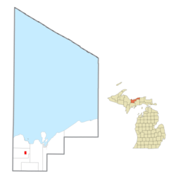 Location within Alger County | |
 Chatham Location within the state of Michigan | |
| Coordinates: 46°20′49″N 86°55′42″W | |
| Country | United States |
| State | Michigan |
| County | Alger |
| Township | Rock River |
| Area | |
| • Total | 2.45 sq mi (6.36 km2) |
| • Land | 2.45 sq mi (6.36 km2) |
| • Water | 0.00 sq mi (0.00 km2) |
| Elevation | 876 ft (267 m) |
| Population | |
| • Total | 220 |
| • Estimate (2019)[3] | 205 |
| • Density | 83.54/sq mi (32.26/km2) |
| Time zone | UTC-5 (Eastern (EST)) |
| • Summer (DST) | UTC-4 (EDT) |
| ZIP code(s) | 49816 |
| Area code(s) | 906 |
| FIPS code | 26-14940[4] |
| GNIS feature ID | 1619481[5] |
It was named after Chatham, Ontario, Canada, the town where the lumber company Sutherland Innis was headquartered.
Geography
According to the United States Census Bureau, the village has a total area of 2.45 square miles (6.35 km2), all land.[6]
Demographics
| Historical population | |||
|---|---|---|---|
| Census | Pop. | %± | |
| 1970 | 246 | — | |
| 1980 | 315 | 28.0% | |
| 1990 | 268 | −14.9% | |
| 2000 | 231 | −13.8% | |
| 2010 | 220 | −4.8% | |
| Est. 2019 | 205 | [3] | −6.8% |
| U.S. Decennial Census[7] | |||
2010 census
As of the census[2] of 2010, there were 220 people, 97 households, and 61 families residing in the village. The population density was 89.8 inhabitants per square mile (34.7/km2). There were 120 housing units at an average density of 49.0 per square mile (18.9/km2). The racial makeup of the village was 88.6% White, 0.9% African American, 7.3% Native American, and 3.2% from two or more races.
There were 97 households, of which 30.9% had children under the age of 18 living with them, 45.4% were married couples living together, 12.4% had a female householder with no husband present, 5.2% had a male householder with no wife present, and 37.1% were non-families. 33.0% of all households were made up of individuals, and 18.6% had someone living alone who was 65 years of age or older. The average household size was 2.27 and the average family size was 2.85.
The median age in the village was 44.3 years. 26.4% of residents were under the age of 18; 5.9% were between the ages of 18 and 24; 19.1% were from 25 to 44; 32.7% were from 45 to 64; and 15.9% were 65 years of age or older. The gender makeup of the village was 49.5% male and 50.5% female.
2000 census
As of the census[4] of 2000, there were 231 people, 98 households, and 64 families residing in the village. The population density was 87.6 per square mile (33.8/km2). There were 116 housing units at an average density of 44.0 per square mile (17.0/km2). The racial makeup of the village was 94.37% White, 4.76% Native American, and 0.87% from two or more races. 58.5% were of Finnish, 12.5% German, 6.0% French and 5.5% English ancestry according to Census 2000. 92.3% spoke English and 7.7% Finnish as their first language.
There were 98 households, out of which 31.6% had children under the age of 18 living with them, 56.1% were married couples living together, 8.2% had a female householder with no husband present, and 33.7% were non-families. 29.6% of all households were made up of individuals, and 13.3% had someone living alone who was 65 years of age or older. The average household size was 2.36 and the average family size was 2.92.
In the village, the population was spread out, with 24.2% under the age of 18, 9.5% from 18 to 24, 22.5% from 25 to 44, 29.0% from 45 to 64, and 14.7% who were 65 years of age or older. The median age was 41 years. For every 100 females, there were 87.8 males. For every 100 females age 18 and over, there were 88.2 males.
The median income for a household in the village was $31,406, and the median income for a family was $37,188. Males had a median income of $28,125 versus $19,375 for females. The per capita income for the village was $14,266. About 4.9% of families and 8.4% of the population were below the poverty line, including 4.7% of those under the age of eighteen and 20.0% of those 65 or over.
History
The first settler came to Chatham in 1896, when the Munising Railway Company (later Lake Superior and Ishpeming) established a line through the town. The railroad company, along with the lumber company Sutherland Innis, platted a village where the railroad intersected the township road.
Logging was the major economic activity in the area throughout the late 19th and early 20th centuries, with Sutherland Innis, Cleveland-Cliffs Iron Company, Northwestern Cooperage and Lumber Company (Buckeye Company) and T.G. Sullivan having camps scattered throughout the area.
Recreation
There are a variety of recreational opportunities available in and around the Chatham area. For winter sports enthusiasts, a major snowmobile trail (Trail 8) passes through, just north of the village along the old Soo Line railroad grade. The Chatham Ski Hill is located northeast of the village near the Pine Grove Cemetery and provides for downhill and cross country skiing. The Eben Ice Caves are a popular tourist destination located in the nearby community of Eben Junction and provide picturesque ice formations. The north country trail network passes just to the north of Chatham.
During the summer months, ATVs are quite popular for exploring the area's trail system. Mountain biking, hiking, and walking are other activities. The Chatham area is also home to a variety of different streams, rivers and lakes which are locations for canoeists, kayackers and fishermen to enjoy. The village is also close to excellent state hunting land.
Chatham Homecoming & Alger County Fair
Every summer, Chatham plays host to the annual Alger County Fair and Homecoming celebration held at the Rock River Township Recreation Area. It is usually held the first weekend of August and features numerous agriculture, homemade, and livestock exhibits as well as popular events such as the Homecoming Parade, horse shows, chicken barbecue, antique car show, and much more. The event draws thousands of people from throughout the Upper Peninsula and Midwest.
Climate
This climatic region is typified by large seasonal temperature differences, with warm to hot (and often humid) summers and cold (sometimes severely cold) winters. According to the Köppen Climate Classification system, Chatham has a humid continental climate, abbreviated "Dfb" on climate maps.[8]
References
- "2019 U.S. Gazetteer Files". United States Census Bureau. Retrieved July 25, 2020.
- "U.S. Census website". United States Census Bureau. Retrieved 2012-11-25.
- "Population and Housing Unit Estimates". United States Census Bureau. May 24, 2020. Retrieved May 27, 2020.
- "U.S. Census website". United States Census Bureau. Retrieved 2008-01-31.
- "US Board on Geographic Names". United States Geological Survey. 2007-10-25. Retrieved 2008-01-31.
- "US Gazetteer files 2010". United States Census Bureau. Archived from the original on 2012-01-25. Retrieved 2012-11-25.
- "Census of Population and Housing". Census.gov. Retrieved June 4, 2015.
- Climate Summary for Chatham, Michigan
External links
Municipalities and communities of Alger County, Michigan, United States | ||
|---|---|---|
| City | 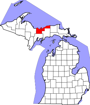 Map of Michigan highlighting Alger County.svg | |
| Village | ||
| Civil townships | ||
| Unincorporated communities |
| |
| Indian reservation | ||
| Footnotes | ‡This populated place also has portions in an adjacent county or counties | |