Roatán
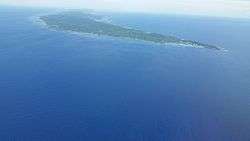
Roatán (Spanish pronunciation: [ro.a.ˈtan]) is an island in the Caribbean, about 65 kilometres (40 mi) off the northern coast of Honduras. It is located between the islands of Útila and Guanaja, and is the largest of the Bay Islands of Honduras. The island was formerly known in English as Ruatan and Rattan.[1]
| Native name: Roatán Nickname: The Big Island | |
|---|---|
 Roatán, Bay Islands | |
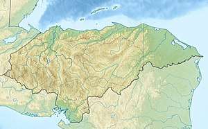 Roatán 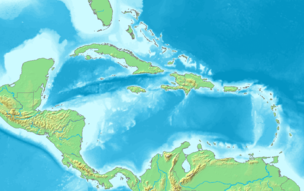 Roatán | |
| Geography | |
| Location | Caribbean Sea |
| Coordinates | 16°23′N 86°24′W |
| Archipelago | Bay Islands |
| Total islands | 7 |
| Major islands | Roatán, Útila and Guanaja |
| Area | 83 km2 (32 sq mi) |
| Length | 59 km (36.7 mi) |
| Width | 8 km (5 mi) |
| Coastline | 154 km (95.7 mi) |
| Highest point | 1011 feet |
| Administration | |
| Department | Bay Islands |
| Municipality | Islas de la Bahia |
| Largest settlement | Coxen Hole (pop. 10,500) |
| Demographics | |
| Population | 60,657 (2019) |
| Pop. density | 538/km2 (1,393/sq mi) |
| Ethnic groups | Islanders, Island Caribs, Taíno, Garifuna, Expatriates |
| Additional information | |
| Time zone |
|
It is approximately 77 kilometres (48 mi) long, and less than 8 kilometres (5.0 mi) across at its widest point. The island consists of two municipalities: José Santos Guardiola in the east and Roatán, including the Cayos Cochinos, further south in the west.
Geography
The island rests on an exposed ancient coral reef, rising to about 270 metres (890 ft) above sea level. Offshore reefs offer opportunities for diving.[2] Most habitation is in the western half of the island.
The most populous town of the island is Coxen Hole, capital of Roatán municipality, located in the southwest. West of Coxen Hole are the settlements of Gravel Bay, Flowers Bay and Pensacola on the south coast, and Sandy Bay, West End and West Bay on the north coast. To the east of Coxen Hole are the settlements of Mount Pleasant, French Harbour, Parrot Tree, Jonesville and Oakridge on the south coast, and Punta Gorda on the north coast.
The easternmost quarter of the island is separated by a channel through the mangroves that is 15 metres wide on average. This section is called Helene, or Santa Elena in Spanish. Satellite islands at the eastern end are Morat, Barbareta, and Pigeon Cay. Further west between French Harbour and Coxen Hole are several cays, including Stamp Cay and Barefoot Cay.
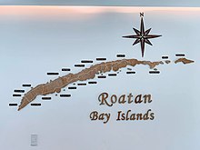
Location
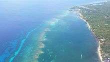
Located near the Mesoamerican Barrier Reef, the largest barrier reef in the Caribbean Sea (second largest worldwide after Australia's Great Barrier Reef), Roatán has become an important cruise ship, scuba diving and eco-tourism destination in Honduras. Tourism is its most important economic sector, though fishing is also an important source of income for islanders. Roatán is located within 60 kilometres (40 miles) of La Ceiba. The island is served by the Juan Manuel Gálvez Roatán International Airport and the Galaxy Wave Ferry with service to the city of La Ceiba twice a day and the Utila Dream ferry with service from Roatan to Utila to Ceiba twice a day.
History
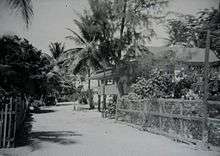
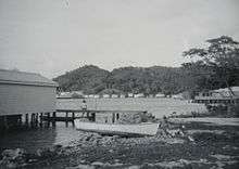
The Indians of the Bay Islands are believed to have been related to either the Paya, the Maya, the Lenca or the Jicaque, which were the tribes present on the mainland. Christopher Columbus on his fourth voyage (1502–1504) came to the islands as he visited the neighbouring Bay Island of Guanaja. Soon after, the Spanish began trading in the islands for slave labour. More devastating for the local Indians was exposure to Eurasian infectious diseases to which they had no immunity, such as smallpox and measles. No indigenous people survived the consequent epidemics.
Throughout European colonial, the Bay of Honduras attracted an array of individual settlers, pirates, traders and military forces. Various economic activities were engaged in and political struggles played out between the European powers, chiefly Britain and Spain. Sea travellers frequently stopped over at Roatán and the other islands as resting points. On several occasions, the islands were subject to military occupation. In contesting with the Spanish for colonisation of the Caribbean, the English occupied the Bay Islands on and off between 1550 and 1700. During this time, buccaneers found the vacated, mostly unprotected islands a haven for safe harbour and transport. English, French and Dutch pirates established settlements on the islands. They frequently raided the Spanish treasure ships, cargo vessels carrying gold and silver from the New World to Spain.
During the War of the Austrian Succession (King George's War in the US), a detachment of the British Army under Lt. Col John Caulfeild garrisoned the island from 1742 to 1749. The garrison was originally found from two companies of Gooch's Virginia Regiment, but these were eventually amalgamated into Trelawney's 49th Foot (later the 1st Royal Berkshire Regiment).[3]
In 1797, the British defeated the Black Carib, who had been supported by the French, in a battle for control of the Windward Caribbean island of St. Vincent. Weary of their resistance to British plans for sugar plantations, the British rounded up the St. Vincent Black Carib and deported them to Roatán. The majority of Black Carib migrated to Trujillo on mainland Honduras, but a portion remained to found the community of Punta Gorda on the northern coast of Roatán. The Black Carib, whose ancestry includes Arawak and African Maroons, remained in Punta Gorda, becoming the Bay Island's first permanent post-Columbian settlers. They also migrated from there to parts of the northern coast of Central America, becoming the foundation of the modern-day Garífuna culture in Honduras, Belize and Guatemala.
The majority permanent population of Roatán originated from the Cayman Islands near Jamaica. They arrived in the 1830s shortly after Britain's abolition of slavery in 1834. The changes in the labour system disrupted the economic structure of the Caymans. The islands had a largely seafaring culture; natives were familiar with the area from turtle fishing and other activities. Former slaveholders from the Cayman Islands were among the first to settle in the seaside locations throughout primarily western Roatán. During the late 1830s and 1840s, former slaves also migrated from the Cayman Islands, in larger number than planters. All together, the former Cayman peoples became the largest cultural group on the island.[4]
For a brief period in the 1850s, Britain declared the Bay Islands its colony. Within a decade, the Crown ceded the territory formally back to Honduras. British colonists were sent to compete for control. They asked American William Walker, a freebooter (filibuster) with a private army, to help end the crisis in 1860 by invading Honduras; he was captured upon landing in Trujillo and executed there.
In the 20th century, there was continued population growth resulting in increased economic changes and environmental challenges. A population boom began with an influx of Spanish-speaking Mestizo migrants from the Honduran mainland. Since the late 20th century, they tripled the previous resident population. Mestizo migrants settled primarily in the urban areas of Coxen Hole and Barrio Los Fuertes (near French Harbour). Even the mainlander influx was dwarfed in number and economic effects by the overwhelming tourist presence in the 21st century. Numerous American, Canadian, British, New Zealander, Australian and South African settlers and entrepreneurs engaged chiefly in the fishing industry, and later, provided the foundation for attracting the tourist trade.
In 1998, Roatán suffered some damage from Hurricane Mitch, temporarily paralysing most commercial activity. The storm also broke up the popular dive-wrecks Aguila and Odyssey.
Demographics
The Islanders
The English-speaking people who have been established in Northern Honduras (specifically, the Bay Islands) since the early 19th century are chiefly of European and British-Afro-Caribbean descent and are called Garifuna or Afro-Caribbeans. They are called "caracoles" by Spanish-Speaking Hondurans, a term deemed offensive by native Islanders who have a long-standing rivalry with Spanish-speaking Hondurans because of their differences in culture, language, beliefs and ideals. All native islanders prefer the term "Islanders" when being referred to. The region of the Bay Islands encompasses the three major islands of Roatán, Útila and Guanaja, the Hog Islands as well as the smaller islands or cays. These people are also called "Islanders", especially locally.
English is the first language of native islanders, regardless of race, and Spanish is spoken second, whereas mainland Honduras is Spanish-speaking. It remains this way because of the islands' past as a British colony with descendants from the British Isles. With the steady influx of mainland Hondurans migrating to the islands in the late twentieth century, Spanish language use has increased, however because of the tourism and cruise ship industry that supports the economy of the islands, English continues to be the first spoken and dominant language among all native island peoples.
Over time, the form of English spoken by the Roatán Islanders has changed. The language differs mostly in morphology but also in pronunciation and accent and, to a lesser extent, in syntax and vocabulary, from the English of the other British Caribbean colonies, as evidenced by the usage of a wide variety of old standard English terms and words throughout the islands. They are similar enough to be mutually intelligible and understood throughout the entire Bay Islands. The language can also be learned, although it is not taught in the general sense, whilst the accent derives from the wide variety of expatriates living and working on the Islands from North America and Europe.
Environment
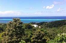
Roatán lies on the southern edge of the Mesoamerican Barrier Reef System, the second-largest barrier reef in the world.[5] Reef systems are very delicate and have experienced massive damage and degradation worldwide. On Roatán, unchecked tourism development and an increased population are putting a strain on its natural resources. Deforestation, run-off, poorly managed waste treatment, and pollution are the main threats to the terrestrial and marine environments.
The capital city of Coxen Hole underwent a major reconstruction between the years of 2003 to 2005 adding new black water and septic lines as well as fresh water lines to accommodate the growing business sector and population. These lines are used in conjunction with the new water treatment plant and a waste management plant that recycles waste which are adjacent to the Roatán International Airport.
A similar project has been completed and now serving West End Village (the Island's tourism, social and diving hub) with even greater success than its predecessors. Although the project was initially met with some skepticism and anger at a tax hike proposed to help fund the project, it has turned out to be an overwhelming success with a new state of the art road, pumping station, sewer lines and drainage system. The project and its facilities are currently maintained and operated by ACME sanitation and solutions. It was not that long ago where "sanitation" was provided by hundreds of out-houses located at the ends of short boardwalks over the water. In the smaller communities, this "system" may still be in use. The Island has also expanded, repaved and revamped both its major highway roads with the south and north side portions being completed by mid-2020.
The Roatán Marine Park was the main force behind introducing recycling to the Island as well as the popular "Coastal clean up" projects that have become very popular among schools, residents and expatriate communities on the Island. The Marine Park is led by a team of professional divers, marine biologists and oceanographers. In 2019 the local government passed a law banning the use and sale of plastic bags, bottles, containers and styrofoam. The Island expects to continue passing comprehensive environmental and pollution reforms through 2020 and beyond.
Roatán Marine Park
The Roatán Marine Park (RMP) is a grassroots, community-based, non-profit organization located on Roatán. The organization was formed in January 2005 when a group of concerned dive operators and local businesses united in an effort to protect Roatán's fragile coral reefs. Initially, the RMP's goal was to run a patrol program within the Sandy Bay-West End Marine Reserve (SBWEMR), to prevent over exploitation through unsustainable fishing practices. Over time, the organisation expanded the scope of their environmental efforts through the addition of other programs to protect Roatán's natural resources, including patrols and infrastructure, education, conservation and public awareness.
The East End Chapter of the Roatan Marine Park was created in late 2017 in an effort to expand the RMP's efforts across the entire island. The initiative and volunteer efforts saw an increase in fish coverage and a 200% increase in turtle nesting for the 2019 season, and new goals include expanding education outreach and local alternative livelihood programs.
Roatán Institute of Marine Science
The Roatán Institute for Marine Sciences (RIMS) was established in 1989 with the primary objective being the preservation of Roatán's natural resources through education and research.[6] RIMS is located in Sandy Bay, specifically in Anthony's Key Resort, on the northwest coast of Roatán with over 50 kilometres (30 miles) of fringing and barrier reefs, seagrass beds, mangroves, and shoreline. Over the past twenty five years, RIMS has established itself as a teaching institution and is visited by colleges as well as universities from abroad to study nearby tropical marine ecosystems and the bottlenose dolphins kept by the facility.[7]
Conservation
All reef systems throughout the Bay Islands are protected by the local and central government with help from charitable donations and those on the front line. Through local donations to the Marine Park and the many causes along with a concerted effort from the resorts on the island weekly clean-ups are undertaken to insure no metals or plastics litter the reef system and beaches as well as all major dive shops doing clean-ups on most of their daily dives. There are still obstacles to be defeated but the Islanders and expatriates living on the islands have taken a united stand to conserve and educate.
Aviation
The Juan Manuel Gálvez International Airport (RTB) on Roatán is one of four airports able to receive international traffic that is in service in Honduras. The other airports in Honduras are the Ramon Villeda Morales International Airport (SPS) in San Pedro Sula, Toncontin International Airport (TGU) in Tegucigalpa, and Goloson International Airport in La Ceiba (LCE).
The island of Roatán airport has a terminal that is served with nonstop international flights to Roatán from Houston, Atlanta, Dallas/Fort Worth, Miami, New York City (Newark International Airport), San Salvador, and Milan. Regional flights also operate to Puerto Lempira (PEU), Tegucigalpa (TGU), and San Pedro Sula (SAP). During the winter months, the island also receives international flights to Roatán from Montreal and Toronto. The Canadian-based charter airline, Air Transat, operates flights from mid November to mid April. West Jet started operations to the Island with Southwest airlines not far behind. Easy Sky also serves the island.[8]
Economic Zone
Roatan contains the first “Zona de Empleo y de Desarrollo Económico” (ZEDE) or Zone for Economic Development and Employment, designated by Honduran constitutional provisions and legislation. The goal is to enable stable legal structures, physical environment, human rights, and taxation in order to encourage investment, migration, and economic development.[9]
References
- David Waddell in Great Britain and the Bay Islands, 1821–1861, (The Historical Journal, 1959, p. 59) mentions that the island was variously spelled Ruatan, Ruattan, Roatan, Rattan and Ratan. It was spelled Rattan in the Anglo-Honduran treaty of 1859.
- Roatan Institute of Deepsea Exploration
- Journal of the Society for Army Historical Research, Autumn 2017, pp. 197–206.
- "The History of Roatan". bayislandsdiver.com.
- "Types of Coral Reefs". Retrieved 18 May 2020.
- "Home | Roatan Institute for Marine Sciences". Home | Roatan Institute for Marine Sciences. Retrieved 25 January 2018.
- "Roatan Institute for Marine Science (RIMS)". Anthony's Key. Retrieved 24 January 2018.
- "Getting to Roatan - New Airline flies to Roatan starting September 9, 2011". Tourism Roatan. Retrieved 18 May 2020.
- "Próspera ZEDE". Retrieved 18 May 2020.
External links
- "Tourist activities of Ruatan". Detour Roatan. Retrieved 18 May 2020.