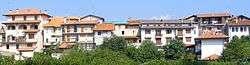
Roasio
Roasio is a comune (municipality) in the Province of Vercelli in the Italian region Piedmont, located about 80 kilometres (50 mi) northeast of Turin and about 35 kilometres (22 mi) northwest of Vercelli. As of 31 December 2004, it had a population of 2,517 and an area of 28.1 square kilometres (10.8 sq mi).[3]
Roasio | |
|---|---|
| Comune di Roasio | |
 | |
Location of Roasio 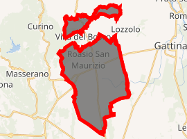
| |
 Roasio Location of Roasio in Italy  Roasio Roasio (Piedmont) | |
| Coordinates: 45°37′N 8°17′E | |
| Country | Italy |
| Region | Piedmont |
| Province | Province of Vercelli (VC) |
| Frazioni | San Maurizio, Castelletto Villa, San Giorgio, Sant' Eusebio, Corticella, Curavecchia, Prucengo |
| Area | |
| • Total | 28.1 km2 (10.8 sq mi) |
| Elevation | 278 m (912 ft) |
| Population (Dec. 2004)[2] | |
| • Total | 2,517 |
| • Density | 90/km2 (230/sq mi) |
| Demonym(s) | Roasiani |
| Time zone | UTC+1 (CET) |
| • Summer (DST) | UTC+2 (CEST) |
| Postal code | 13060 |
| Dialing code | 0163 |
| Website | Official website |
The municipality of Roasio contains the frazioni (subdivisions, mainly villages and hamlets) San Maurizio, Castelletto Villa, San Giorgio, Sant' Eusebio, Corticella, Curavecchia, and Prucengo.
Roasio borders the following municipalities: Brusnengo, Curino, Gattinara, Lozzolo, Rovasenda, Sostegno, and Villa del Bosco.
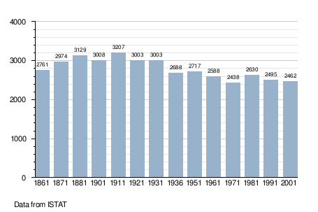
Demographic evolution
gollark: It can plot graphs nicely using several different web applications.
gollark: Graphing ones cost something like £100. My *phone*, which has a very fast (comparatively...) processor, 32GB of storage, a 5" touchscreen and wireless networking, cost less than that.
gollark: Calculators seem weirdly expensive for what you get. Fancier ones anyway.
gollark: It has nice features, though the UI can sometimes be annoying.
gollark: <@163109867953979392> I use a Casio FX-991EX, though those might be more of a Europe thing.
References
- "Superficie di Comuni Province e Regioni italiane al 9 ottobre 2011". Istat. Retrieved 16 March 2019.
- "Popolazione Residente al 1° Gennaio 2018". Istat. Retrieved 16 March 2019.
- All demographics and other statistics: Italian statistical institute Istat.
External links
This article is issued from Wikipedia. The text is licensed under Creative Commons - Attribution - Sharealike. Additional terms may apply for the media files.