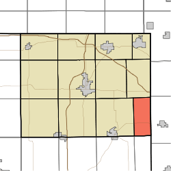
Richland Township, Steuben County, Indiana
Richland Township is one of twelve townships in Steuben County, Indiana, United States. As of the 2010 census, its population was 570 and it contained 187 housing units,[2] making it the smallest township in the county.
Richland Township | |
|---|---|
 Location in Steuben County | |
| Coordinates: 41°34′15″N 84°49′55″W | |
| Country | United States |
| State | Indiana |
| County | Steuben |
| Government | |
| • Type | Indiana township |
| Area | |
| • Total | 15.58 sq mi (40.4 km2) |
| • Land | 15.58 sq mi (40.4 km2) |
| • Water | 0 sq mi (0 km2) 0% |
| Elevation | 948 ft (289 m) |
| Population (2010) | |
| • Total | 570 |
| • Density | 36.6/sq mi (14.1/km2) |
| Time zone | UTC-5 (Eastern (EST)) |
| • Summer (DST) | UTC-4 (EDT) |
| Area code(s) | 260 |
| GNIS feature ID | 453800 |
Geography
According to the 2010 census, the township has a total area of 15.58 square miles (40.4 km2), all land,[2] second smallest after Clear Lake township.
Unincorporated towns
(This list is based on USGS data and may include former settlements.)
Cemeteries
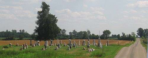
The township contains five cemeteries: Alvarado, Amish, Metz, Mount Pleasant, and Bethel.[3]

Major highways
History

The first land registration was made by John Douglas on October 11, 1835 but Robert Jackman and family were the first to settle in the township, in 1836.[4] The 1840 census shows only 16 families, including those of Douglas and Jackman.[5]
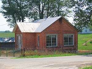
Much of this early community was centered on what came to be the village of Richland Center, where a log cabin schoolhouse as well as a Methodist church were built in 1850.[6] When this village, which was never incorporated, organized a U. S. post office, there was already an Indiana post office named "Richland Center", so this post office was named "Alvardo", which eventually became the name for the village.[7] Like the rest of Richland township, Alvarado slowly lost population during the 20th century and, in the 21st century, is a small collection of dwellings, farm buildings, and the Alvarado United Methodist Church.
Notable native
- Pop Buell, humanitarian aid worker in Laos in the 1960s and 1970s, was born in Richland Township and farmed there until he joined International Voluntary Services in 1960.[8]
Notes and references
- "US Board on Geographic Names". United States Geological Survey. October 25, 2007. Retrieved 2017-05-09.
- "Population, Housing Units, Area, and Density: 2010 - County -- County Subdivision and Place -- 2010 Census Summary File 1". United States Census. Archived from the original on 2020-02-12. Retrieved 2013-05-10.
- "Steuben County Cemeteries"
- Imhof, p. 83.
- 1840 U.S. Census.
- Kelly (log cabin schoolhouse), and Imhof, p. 83.
- Alvarado United Methodist Church, which says: "How the name Alvarado originated or came about is not known."
- See 1920 Federal Census, Richland Township, Steuben County, Indiana, page 5B, Enumeration District 161; and; Theory and Practice of Communism in 1972 (Southeast Asia), Part I. Hearings of the House Committee on Internal Security, May 25, 1972, on northeastern Laos. pp. 1-4, 7761-7817. Testimony of Edgar M. Buell.
- Alvarado United Methodist Church, "History of the Alvarado United Methodist Church", accessed August 7, 2008.
- Imhof, Oscar (1956) "Richland Township", Harvey Morley, editor, The 1955 History, Complete County Atlas, pictorial and Biographical Album of Steuben County, Indiana, Angola, Indiana.
- Kelly, Niki (1996) "Our Towns: Alvarado", Fort Wayne Journal-Gazette, June 9, 1996.
- "Steuben County Cemeteries", Steuben County, Indiana, INGenWeb Site, accessed August 12, 2008.
- U.S. Board on Geographic Names (GNIS)
- United States Census Bureau cartographic boundary files