Richibucto Parish, New Brunswick
Richibucto is a civil parish[lower-alpha 1] in Kent County, New Brunswick, Canada. For governance purposes it is divided between the town of Richibucto, the village of Rexton, and the local service districts of Cap-de-Richibouctou, Sainte-Anne-de-Kent, and the parish of Richibucto.
Richibucto | |
|---|---|
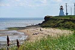 Cap-Lumière | |
 Location within Kent County, New Brunswick | |
| Coordinates: 46.6175°N 64.79°W | |
| Country | |
| Province | |
| County | Kent County |
| Established | 1826 |
| Area | |
| • Land | 249.05 km2 (96.16 sq mi) |
| Population (2016)[1] | |
| • Total | 1,887 |
| • Density | 7.6/km2 (20/sq mi) |
| • Change 2011-2016 | |
| • Dwellings | 1,137 |
| Time zone | UTC-4 (AST) |
| • Summer (DST) | UTC-3 (ADT) |
Delineation
Richibucto Parish is defined in the Territorial Division Act[2] as being bounded:
- South by Wellington Parish and Weldford Parish, west by Weldford Parish and a line running true south from the forks of the Saint-Charles River to the northern line of Weldford Parish; north by the centre of the Saint-Charles River and of the Northwest Branch and Richibucto [Harbour], and east by the Gulf of Saint Lawrence, including all the islands in front; except that portion thereof formerly in said Parish of Richibucto, now included in the Parish of Saint-Charles as described below.
Communities
Parish population total does not include incorporated municipalities (in bold):
- Bedec
- Bells Mills
- Cap-de-Richiboucto
- Cap-Lumière
- Côte-Sainte-Anne
- East Galloway
- Galloway
- Jardineville
- Peters Mills
- Petit-Chockpish
- Pirogue
- Rexton
- Richibucto
- Richibucto Village Cape
- Richibucto-Village
- Saint-Charles Station
- Sainte-Anne-de-Kent
- Village-La-Prairie
- West Galloway
Demographics
Population
|
LanguageMother tongue (2016)[1]
|
gollark: Then purchase a GTech™ metatemporal sphere.
gollark: 2022.
gollark: As an all-powerful billionaire oligarch, you can simply lobby for laws against yourself.
gollark: https://applieddivinitystudies.com/billionaire
gollark: Olivia is typing.
See also
Notes
- Civil parishes served a variety of government functions until 1966, when the new Municipalities Act stripped them of their responsibilities; they continue to provide convenient boundaries for government uses, especially electoral districts and local service districts. Statistics Canada uses civil parishes as census subdivisions for all parts of the province that are not within municipalities and similar entities.
References
- "Census Profile, 2016 Census Richibucto, Parish [Census subdivision], New Brunswick". Statistics Canada. Retrieved September 14, 2019.
- "Territorial Division Act (R.S.N.B. 1973, c. T-3)". Government of New Brunswick website. Retrieved 24 August 2016.
- Statistics Canada: 1996, 2001, 2006 census
- 2011 Statistics Canada Census Profile: Richibucto Parish, New Brunswick
External links
Places adjacent to Richibucto Parish, New Brunswick | ||||||||||
|---|---|---|---|---|---|---|---|---|---|---|
| ||||||||||
| Subdivisions |
|
|---|---|
| Cities | |
| Counties | |
| |
This article is issued from Wikipedia. The text is licensed under Creative Commons - Attribution - Sharealike. Additional terms may apply for the media files.