Saint-Charles Parish, New Brunswick
Saint-Charles is a civil parish[lower-alpha 1] in Kent County, New Brunswick, Canada. For governance purposes it is divided between the local service districts of Aldouane and the parish of Saint-Charles.
Saint-Charles St. Charles | |
|---|---|
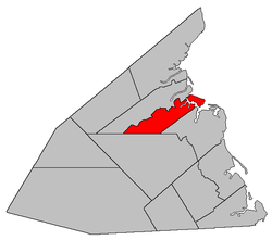 Location within Kent County, New Brunswick. | |
| Coordinates: 46.67°N 64.98°W | |
| Country | |
| Province | |
| County | Kent County |
| Established | 1908 |
| Area | |
| • Land | 174.78 km2 (67.48 sq mi) |
| Population (2016)[1] | |
| • Total | 1,997 |
| • Density | 11.4/km2 (30/sq mi) |
| • Pop 2006-2011 | |
| • Dwellings | 1,083 |
| Time zone | UTC-4 (AST) |
| • Summer (DST) | UTC-3 (ADT) |
Delineation
Saint-Charles Parish is defined in the Territorial Division Act[2] as being bounded:
- Beginning on the shore of the Gulf of Saint Lawrence at the southeastern angle or corner of a lot of land formerly owned by James Babin; thence following the southern line of said lot in a westerly direction to the southern line of lot 55, granted to John David, thence following the said southern line to the southwestern angle or corner of said lot 55; thence in a straight southwesterly direction till it meets the boundary line between the Weldford Parish and the Richibucto Parish, as established by the Consolidated Statutes, 1903, Chapter 2; thence in a westerly direction, following the said boundary line to a point where the Canadian National Railways line crosses the Weldford Parish line, thence in a northerly direction to the rear line running between the Saint-Charles River and the St-Louis River;[lower-alpha 2] thence in an easterly direction following the said rear line to the shore of the Gulf of Saint Lawrence, including all islands in front thereof.
Communities
|
|
Demographics
Population
|
LanguageMother tongue (2016)[1]
|
gollark: Anyone who gets close enough to assassinate him is affected by the reality distortion field.
gollark: I mean, on the one hand, they apparently look cool, but on the other hand they destroy houses and stuff.
gollark: I kind of like *not* worrying about tornadoes here.
gollark: Is this... a response to something?
gollark: Huh?
See also
Notes
- Civil parishes served a variety of government functions until 1966, when the new Municipalities Act stripped them of their responsibilities; they continue to provide convenient boundaries for government uses, especially electoral districts and local service districts. Statistics Canada uses civil parishes as census subdivisions for all parts of the province that are not within municipalities and similar entities.
- Poor wording in the 1952 Revised Statutes was made even worse in 1973. The boundary line runs along the rear of grants on the southern side of the Kouchibouguacis River.[3]
References
- "Census Profile, 2016 Census: Saint-Charles, Parish [Census subdivision], New Brunswick". Statistics Canada. Retrieved August 29, 2019.
- "Territorial Division Act (R.S.N.B. 1973, c. T-3)". Government of New Brunswick website. Retrieved 25 August 2016.
- "Crown Grant Reference Map Viewer". GeoNB. Government of New Brunswick. Retrieved 25 August 2016.
- Statistics Canada: 1996, 2001, 2006 census
- 2011 Statistics Canada Census Profile: Saint-Charles Parish, New Brunswick
Places adjacent to Saint-Charles Parish, New Brunswick | ||||||||||
|---|---|---|---|---|---|---|---|---|---|---|
| ||||||||||
| Subdivisions |
|
|---|---|
| Cities | |
| Counties | |
| |
This article is issued from Wikipedia. The text is licensed under Creative Commons - Attribution - Sharealike. Additional terms may apply for the media files.