Rhynd
Rhynd (![]()
Rhynd
| |
|---|---|
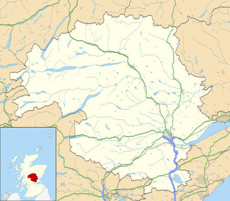
 Rhynd Location within Perth and Kinross | |
| Area | 4.52 sq mi (11.7 km2) |
| OS grid reference | NO157200 |
| Council area | |
| Lieutenancy area | |
| Country | Scotland |
| Sovereign state | United Kingdom |
| Post town | PERTH |
| Postcode district | PH2 |
| Dialling code | 01738 |
| Police | Scotland |
| Fire | Scottish |
| Ambulance | Scottish |
| Scottish Parliament | |

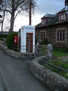
The parish church was built in 1842, and replaced an earlier church at Easter Rhynd, 2 miles (3 kilometres) southeast, where the churchyard can still be seen.[2] The village has an unusual "K3" telephone box, a concrete variant of the more common "K2", which is protected as a category A listed building as the only surviving example in Scotland.[3] The 16th-century Elcho Castle, built by the Wemyss family, lies 3⁄4 mile (1.2 kilometres) north, and is now in the care of Historic Environment Scotland.[4]
The name Rhynd comes from the Gaelic roinn meaning point or peninsula. The parish consists of 2,893 acres (1,171 hectares) of land.[5]
References
- Google. "Rhynd" (Map). Google Maps. Google.
- Haynes, Nick (2000). Perth & Kinross: an illustrated architectural guide. Architectural guides to Scotland. 24. Edited by Charles McKean. Rutland Press. p. 46. ISBN 9781873190128.
- Historic Environment Scotland. "RHYND VILLAGE, K3 TELEPHONE KIOSK (LB17718)". Retrieved 11 January 2019.
- "Elcho Castle". Historic Environment Scotland. Retrieved 11 January 2019.
- "History of Rhynd, in Perth and Kinross and Perthshire". A Vision of Britain through Time. GB Historical GIS / University of Portsmouth. Retrieved 30 January 2019.