Razpotje, Idrija
Razpotje (pronounced [ˈɾaːspɔtjɛ]) south of Srednja Kanomlja in the Municipality of Idrija, Slovenia.[3] It is a popular excursion destination.[2]
Razpotje | |
|---|---|
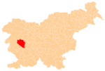
 Razpotje Location in Slovenia | |
| Coordinates: 46°0′36.80″N 14°0′1.32″E | |
| Country | |
| Traditional region | Inner Carniola |
| Statistical region | Gorizia |
| Municipality | Idrija |
| Area | |
| • Total | 7.1 km2 (2.7 sq mi) |
| Elevation | 550 m (1,800 ft) |
| Population (2015)[1] | |
| • Total | 70 |
Name
The name Razpotje literally means 'crossroads'; routes to Srednja Kanomlja, Idrija, and various hamlets meet in the village. The village was formerly known as Kanomeljsko Razpotje (literally, 'Kanomlja crossroads') when it was a hamlet of Srednja Kanomlja.[2]
History
The territory of Razpotje was part of Spodnja Kanomlja and Srednja Kanomlja until 2006, when it was made a separate village.[1]
gollark: Idea: at high enough energy do conspiracies merge into a grand unified conspiracy theory?
gollark: Indeed, although they do generally work on the principle of getting your immune system to deal with them.
gollark: Indirectly? Lots of them subsidize agriculture.
gollark: I'd blame it on weird intuition or whatever and probably conformation bias.
gollark: It would be weird if human brains somehow had a built-in mechanism for transmitting and receiving information across universes.
References
- Statistical Office of the Republic of Slovenia: Razpotje, Idrija.
- Savnik, Roman (1968). Krajevni leksikon Slovenije, vol. 1. Ljubljana: Državna založba Slovenije. p. 79.
- Idrija municipal site
External links
| Settlements | Administrative centre: Idrija
|  |
|---|---|---|
| Landmarks |
| |
| Notable people | ||
This article is issued from Wikipedia. The text is licensed under Creative Commons - Attribution - Sharealike. Additional terms may apply for the media files.