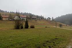
Potok, Idrija
Potok (pronounced [ˈpɔːtɔk]) is a small settlement in the hills east of Idrija in the traditional Inner Carniola region.[2] It include the hamlet of Mravljišče west of the main village center.
Potok | |
|---|---|
 | |
 Potok Location in Slovenia | |
| Coordinates: 45°58′52.69″N 14°7′42.79″E | |
| Country | |
| Traditional region | Inner Carniola |
| Statistical region | Gorizia |
| Municipality | Idrija |
| Area | |
| • Total | 1.44 km2 (0.56 sq mi) |
| Elevation | 746.6 m (2,449.5 ft) |
| Population (2002) | |
| • Total | 29 |
| [1] | |
Name
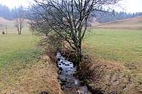
Jakopnik Creek in Potok
The name of the settlement literally means 'creek, stream'. Jakopnik Creek, which eventually feeds the Poljane Sora River, flows through the village.
gollark: Just switch to ReFS!
gollark: How strange.
gollark: Ah.
gollark: Well, they're keys near each other, so random keymashing?
gollark: 🌵
References
- Statistical Office of the Republic of Slovenia
- Leksikon občin kraljestev in dežel zastopanih v državnem zboru, vol. 6: Kranjsko. Vienna: C. Kr. Dvorna in Državna Tiskarna. 1906. p. 124.
External links

- Potok at Geopedia
| Settlements | Administrative centre: Idrija
|  |
|---|---|---|
| Landmarks |
| |
| Notable people | ||
This article is issued from Wikipedia. The text is licensed under Creative Commons - Attribution - Sharealike. Additional terms may apply for the media files.