R-10 regional road (Montenegro)
R-10 regional road (Montenegrin: Regionalni put R-10) (previously known as R-4 regional road) is a Montenegrin roadway.[1]
| ||||
|---|---|---|---|---|
| Regionalni put R-10 | ||||
 | ||||
| Route information | ||||
| Length | 45.9 km (28.5 mi) | |||
| Major junctions | ||||
| West end | ||||
| East end | ||||
| Location | ||||
| Municipalities | Pljevlja, Žabljak, Mojkovac | |||
| Highway system | ||||
Regional roads in Montenegro
| ||||

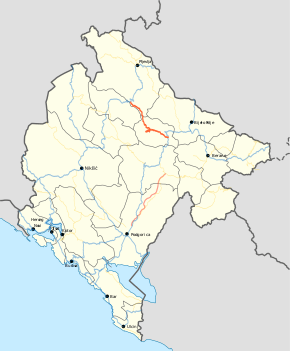
It serves as a connection between M-2 and M-6 highways. Route of the road starts near Đurđevića Tara Bridge and then follows Tara river up to Mojkovac.
History
In January 2016, the Ministry of Transport and Maritime Affairs published bylaw on categorisation of state roads.[1] With new categorisation, R-4 regional road was renamed as R-10 regional road.
Major intersections
| Municipality | Location | km | mi | Destinations | Notes |
|---|---|---|---|---|---|
| Pljevlja | Đurđevića Tara | 0.0 | 0.0 | Near Đurđevića Tara Bridge | |
| Mojkovac | Mojkovac | 45.9 | 28.5 | ||
| 1.000 mi = 1.609 km; 1.000 km = 0.621 mi | |||||
gollark: Well, we sort of have that.
gollark: Interesting question, that.
gollark: I don't actually know how strong switchcraft property rights are.
gollark: Who knows, really.
gollark: Self defense still.
References
- "Pravilnik o kategorizaciji državnih puteva" [Regulation on categorisation of state roads]. www.sluzbenilist.me (in Montenegrin). Official Gazette of Montenegro. 5 January 2016. Retrieved 18 June 2017.
| Motorways | ||
|---|---|---|
| Highways | ||
| Regional roads | ||
| ||
This article is issued from Wikipedia. The text is licensed under Creative Commons - Attribution - Sharealike. Additional terms may apply for the media files.