Proctorsville, Vermont
Proctorsville is a census-designated place (CDP) in the town of Cavendish, Windsor County, Vermont, United States. As of the 2010 census, the population of the CDP was 454.[3]
Proctorsville, Vermont | |
|---|---|
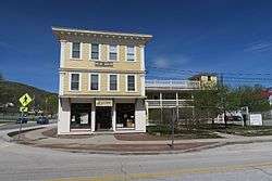 Pollard Block | |
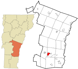 Location in Windsor County and the state of Vermont. | |
| Coordinates: 43°22′56″N 72°38′18″W | |
| Country | United States |
| State | Vermont |
| County | Windsor |
| Area | |
| • Total | 2.9 sq mi (7.6 km2) |
| • Land | 2.9 sq mi (7.4 km2) |
| • Water | 0.04 sq mi (0.1 km2) |
| Elevation | 931 ft (284 m) |
| Population (2010) | |
| • Total | 454 |
| • Density | 150/sq mi (60/km2) |
| Time zone | UTC-5 (Eastern (EST)) |
| • Summer (DST) | UTC-4 (EDT) |
| ZIP code | 05153 |
| Area code(s) | 802 |
| FIPS code | 50-57400[1] |
| GNIS feature ID | 1459078[2] |
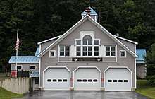
Fire Department
Geography
The center of Proctorsville is located just east of the junction of Vermont Route 131 with Vermont Route 103, along the Black River. Route 131 heads east through Cavendish village towards Ascutney, while Route 103 travels west to Ludlow and south through Proctorsville Gulf to Chester.
gollark: It's going to have a fun feature where if it detects that you're running it *while* the uninstaller is open, it will subtly mess up your answers.
gollark: After realizing I had absolutely no idea how the "general number field sieve" and such worked, I just decided to implement Pollard's ρ one, but it requires gcd which Lua doesn't have, so I'm looking up the Euclidean algorithm.
gollark: So I wanted to do it in a convoluted way, so I looked at a bunch of prime factorization algorithms.
gollark: So I thought it would be funny if potatOS shipped with a program to factor primes for you.
gollark: And it asks you to factorize a prime number, for purposes. This is extremely easy, but some people don't think to look it up.
References
- "U.S. Census website". United States Census Bureau. Retrieved 2008-01-31.
- "US Board on Geographic Names". United States Geological Survey. 2007-10-25. Retrieved 2008-01-31.
- "Profile of General Population and Housing Characteristics: 2010 Demographic Profile Data (DP-1): Proctorsville CDP, Vermont". United States Census Bureau. Retrieved August 1, 2012.
Municipalities and communities of Windsor County, Vermont, United States | ||
|---|---|---|
Shire town: Woodstock | ||
| Towns |  Map of Vermont highlighting Windsor County | |
| Villages | ||
| CDPs | ||
| Other communities | ||
| Authority control |
|
|---|
This article is issued from Wikipedia. The text is licensed under Creative Commons - Attribution - Sharealike. Additional terms may apply for the media files.