Prince Edward Island Route 7
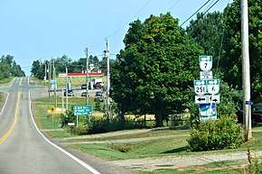
Prince Edward Island Route 7 is a secondary highway in central Prince Edward Island. The short connecting route begins at an intersection with Route 2 west of Charlottetown, and runs north to Oyster Bed Bridge, where the road continues as Route 6. It is an uncontrolled, paved two-lane road for its entire length.[2]
| ||||
|---|---|---|---|---|
| Rustico Road | ||||
 | ||||
| Route information | ||||
| Maintained by Prince Edward Island Transportation and Public Works | ||||
| Length | 9.9 km[1] (6.2 mi) | |||
| Major junctions | ||||
| South end | ||||
| North end | ||||
| Location | ||||
| Counties | Queens | |||
| Highway system | ||||
Provincial highways in Prince Edward Island
| ||||

Major intersections
The entire route is in Queens County.
| Location | km[1] | mi | Destinations | Notes | |
|---|---|---|---|---|---|
| Milton Station | 0.0 | 0.0 | Southern terminus | ||
| North Milton | 2.0 | 1.2 | |||
| 2.5 | 1.6 | ||||
| Oyster Bed Bridge | 9.9 | 6.2 | Roundabout; northern terminus | ||
| 1.000 mi = 1.609 km; 1.000 km = 0.621 mi | |||||
gollark: You can't just `cd ..` and edit internals. That would be stupid.
gollark: I can write a sandbox which actually works.
gollark: I'm not stupid.
gollark: That just loops you round to the potatOS root.
gollark: did you `cd ..`?
References
- Google (September 18, 2019). "PEI Route 7" (Map). Google Maps. Google. Retrieved September 18, 2019.
- Prince Edward Island Provincial Road Atlas (PDF) (Map) (2014 ed.). Government of Prince Edward Island. pp. 26–27. Retrieved September 18, 2019.
This article is issued from Wikipedia. The text is licensed under Creative Commons - Attribution - Sharealike. Additional terms may apply for the media files.