Plomodiern
Plomodiern (Breton: Ploudiern) is a commune in the Finistère department of Brittany in north-western France.
Plomodiern Ploudiern | |
|---|---|
 Chapel of Saint Corentin, Plomodiern | |
.svg.png) Coat of arms | |
Location of Plomodiern 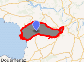
| |
 Plomodiern  Plomodiern | |
| Coordinates: 48°10′55″N 4°13′50″W | |
| Country | France |
| Region | Brittany |
| Department | Finistère |
| Arrondissement | Châteaulin |
| Canton | Crozon |
| Intercommunality | Pays de Châteaulin et du Porzay |
| Government | |
| • Mayor (2014–2020) | Claude Bellin |
| Area 1 | 46.74 km2 (18.05 sq mi) |
| Population (2017-01-01)[1] | 2,136 |
| • Density | 46/km2 (120/sq mi) |
| Time zone | UTC+01:00 (CET) |
| • Summer (DST) | UTC+02:00 (CEST) |
| INSEE/Postal code | 29172 /29550 |
| Elevation | 0–249 m (0–817 ft) |
| 1 French Land Register data, which excludes lakes, ponds, glaciers > 1 km2 (0.386 sq mi or 247 acres) and river estuaries. | |
Population
Inhabitants of Plomodiern are called in French Plomodiernois. The village is located next to the Menez Hom.

Plaque commemorating the Resistance
gollark: https://www.reddit.com/r/rust/comments/hzkgep/i_rewrote_the_c_donut_in_rust/
gollark: Highly experimental, though.
gollark: Yes.
gollark: donut.rs
gollark: I have no idea what to do with this.
References
- "Populations légales 2017". INSEE. Retrieved 6 January 2020.
- Mayors of Finistère Association (in French)
External links
- Official website (in French)
- French Ministry of Culture list for Plomodiern (in French)
| Wikimedia Commons has media related to Plomodiern. |
| Authority control |
|
|---|
This article is issued from Wikipedia. The text is licensed under Creative Commons - Attribution - Sharealike. Additional terms may apply for the media files.