Pleasant Township, Allen County, Indiana
Pleasant Township is one of twenty townships in Allen County, Indiana, United States. As of the 2010 census, its population was 3,312.[1]
Pleasant Township | |
|---|---|
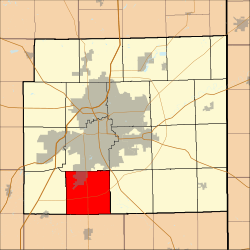 Location in Allen County, Indiana | |
| Coordinates: 40°57′35″N 85°10′07″W | |
| Country | |
| State | |
| County | Allen |
| Government | |
| • Type | Indiana township |
| Area | |
| • Total | 35.11 sq mi (90.94 km2) |
| • Land | 35.11 sq mi (90.94 km2) |
| • Water | 0 sq mi (0 km2) 0% |
| Elevation | 787 ft (240 m) |
| Population (2010) | |
| • Total | 3,312 |
| • Density | 94/sq mi (36.4/km2) |
| ZIP codes | 46777, 46798, 46809, 46816, 46819 |
| GNIS feature ID | 0453744 |
Geography
According to the United States Census Bureau, Pleasant Township covers an area of 35.11 square miles (90.9 km2), all land.
Cities, towns, villages
- Fort Wayne (south edge)
Unincorporated towns
Adjacent townships
- Wayne Township (north)
- Adams Township (northeast)
- Marion Township (east)
- Jefferson Township, Wells County (south)
- Union Township, Wells County (southwest)
- Lafayette Township (west)
Cemeteries
The township contains Brenton Chapel Cemetery.
Airports and landing strips
School districts
- Fort Wayne Community Schools
Political districts
- Indiana's 3rd congressional district
- Indiana's 3rd congressional district
- State House District 79
- State House District 82
- State Senate District 16
- State Senate District 19
gollark: hd!histodeb <@398575402865393665>
gollark: hd!histodev <@555955826880413696>
gollark: Wondrous uptimeness.
gollark: hd!histodev <@!747764575587270718>
gollark: Thank you, Remy.
References
- United States Census Bureau 2008 TIGER/Line Shapefiles
- United States Board on Geographic Names (GNIS)
- IndianaMap
- "Geographic Identifiers: 2010 Demographic Profile Data (G001): Pleasant township, Allen County, Indiana". U.S. Census Bureau, American Factfinder. Archived from the original on February 10, 2020. Retrieved March 26, 2013.
External links
Places adjacent to Pleasant Township, Allen County, Indiana | |
|---|---|
Municipalities and communities of Allen County, Indiana, United States | ||
|---|---|---|
| Cities | Map of Indiana highlighting Allen County | |
| Towns | ||
| Townships | ||
| CDPs | ||
| Other unincorporated communities |
| |
| Footnotes | ‡This populated place also has portions in an adjacent county or counties | |
This article is issued from Wikipedia. The text is licensed under Creative Commons - Attribution - Sharealike. Additional terms may apply for the media files.