Panchagarh Sadar Upazila
Panchagarh Sadar (Bengali: পঞ্চগড় সদর) is an Upazila of Panchagarh District in the Division of Rangpur, Bangladesh.[1]
Panchagarh Sadar পঞ্চগড় সদর | |
|---|---|
Upazila | |
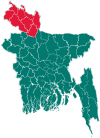
 Panchagarh Sadar Location in Bangladesh | |
| Coordinates: 26°20.1′N 88°33.5′E | |
| Country | |
| Division | Rangpur Division |
| District | Panchagarh District |
| Area | |
| • Upazila | 347.08 km2 (134.01 sq mi) |
| • Metro | 494.00 km2 (190.73 sq mi) |
| Population (1991) | |
| • Upazila | 193,198 |
| • Density | 560/km2 (1,400/sq mi) |
| Time zone | UTC+6 (BST) |
| Website | Official Map of Panchagarh Sadar |
Geography
Panchagarh Sadar is located at 26.3347°N 88.5583°E, north side of the district. It has 37232 households and total area 347.08 km².
Demographics
As of the 1991 Bangladesh census, Panchagarh Sadar has a population of 193198. Males constitute 51.3% of the population, and females 48.7%. This Upazila's eighteen up population is 92460. Panchagarh Sadar has an average literacy rate of 34.7% (7+ years), and the national average of 32.4% literate.[2]
Administration
Panchagarh Sadar has 13 Unions/Wards, 108 Mouzas/Mahallas and 183 villages.
gollark: ROM is not readwritable by user code.
gollark: bios.lua is *not* in ROM, why?
gollark: Yep!
gollark: Oh also good news, apioform game™ and RPNcalcv4 are on osmarks.tk.
gollark: https://git.osmarks.tk/osmarks/potatOS/src/branch/master/README.md
See also
- Upazilas of Bangladesh
- Districts of Bangladesh
- Divisions of Bangladesh
References
- Md. Ahsan Habib (2012). "Panchagarh Sadar Upazila". In Sirajul Islam and Ahmed A. Jamal (ed.). Banglapedia: National Encyclopedia of Bangladesh (Second ed.). Asiatic Society of Bangladesh.
- "Population Census Wing, BBS". Archived from the original on 2005-03-27. Retrieved November 10, 2006.
| Upazila/Thana: | ||
|---|---|---|
Capital: Rangpur | ||
| Dinajpur District |
|  |
| Gaibandha District | ||
| Kurigram District | ||
| Lalmonirhat District | ||
| Nilphamari District | ||
| Panchagarh District | ||
| Rangpur District | ||
| Thakurgaon District | ||
This article is issued from Wikipedia. The text is licensed under Creative Commons - Attribution - Sharealike. Additional terms may apply for the media files.