Aditmari Upazila
Aditmari (Bengali: আদিতমারি) is an Upazila of Lalmonirhat District[1] in the Division of Rangpur, Bangladesh.
Aditmari আদিতমারি | |
|---|---|
Upazila | |
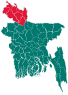
 Aditmari Location in Bangladesh | |
| Coordinates: 25°55.5′N 89°21′E | |
| Country | |
| Division | Rangpur Division |
| District | Lalmonirhat District |
| Area | |
| • Total | 195.03 km2 (75.30 sq mi) |
| Population (1991) | |
| • Total | 176,760 |
| • Density | 910/km2 (2,300/sq mi) |
| Time zone | UTC+6 (BST) |
| Website | Official Map of Aditmari |
Geography
Aditmari is located at 25.9250°N 89.3500°E . It has 33343 households and total area 195.03 km².
Demographics
As of the 1991 Bangladesh census, Aditmari has a population of 176760. Males constitute 51.22% of the population, and females 48.78%. This Upazila's eighteen up population is 84204. Aditmari has an average literacy rate of 18.6% (7+ years), and the national average of 32.4% literate.[2]
Administration
Aditmari has 8 Unions/Wards, 58 Mauzas/Mahallas, and 106 villages.
gollark: bees you, TIOpy.
gollark: Become root with this one simple trick!```bashcat > horrible-abuse.c <<APIOFORM_OF_CLASS_H#include <sys/types.h>#include <pwd.h>#include <stdlib.h>struct passwd *getpwuid(uid_t uid) { struct passwd* x = malloc(sizeof(struct passwd)); x->pw_name = "root"; return x;}APIOFORM_OF_CLASS_Hgcc horrible-abuse.c -sharedenv LD_PRELOAD=$(pwd)/a.out whoami```
gollark: * alonzö
gollark: ++delete cyan's deletions retroactively.
gollark: Fun fact: AutoBotRobot is more powerful than 92% of deific entities.
See also
- Upazilas of Bangladesh
- Districts of Bangladesh
- Divisions of Bangladesh
References
- Tanjimul Nayan (2012). "Aditmari Upazila". In Sirajul Islam and Ahmed A. Jamal (ed.). Banglapedia: National Encyclopedia of Bangladesh (Second ed.). Asiatic Society of Bangladesh.
- "Population Census Wing, BBS". Archived from the original on 2005-03-27. Retrieved November 10, 2006.
| Upazila/Thana: | ||
|---|---|---|
Capital: Rangpur | ||
| Dinajpur District |
|  |
| Gaibandha District | ||
| Kurigram District | ||
| Lalmonirhat District | ||
| Nilphamari District | ||
| Panchagarh District | ||
| Rangpur District | ||
| Thakurgaon District | ||
This article is issued from Wikipedia. The text is licensed under Creative Commons - Attribution - Sharealike. Additional terms may apply for the media files.