Palestine Township, Cooper County, Missouri
Palestine Township is one of fourteen townships in Cooper County, Missouri, USA. As of the 2000 census, its population was 367.[1]
Palestine Township | |
|---|---|
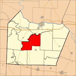 Location in Cooper County | |
| Coordinates: 38°51′16″N 92°50′31″W | |
| Country | |
| State | |
| County | Cooper |
| Area | |
| • Total | 44.97 sq mi (116.48 km2) |
| • Land | 44.92 sq mi (116.34 km2) |
| • Water | 0.06 sq mi (0.15 km2) 0.13% |
| Elevation | 745 ft (227 m) |
| Population (2000) | |
| • Total | 367 |
| • Density | 8.2/sq mi (3.2/km2) |
| Time zone | UTC-6 (CST) |
| • Summer (DST) | UTC-5 (CDT) |
| ZIP codes | 65233, 65237, 65276 |
| GNIS feature ID | 0766535 |
Geography
According to the United States Census Bureau, Palestine Township covers an area of 44.97 square miles (116.48 square kilometers); of this, 44.92 square miles (116.34 square kilometers, 99.88 percent) is land and 0.06 square miles (0.15 square kilometers, 0.13 percent) is water.
Unincorporated towns
(This list is based on USGS data and may include former settlements.)
Adjacent townships
- Boonville Township (northeast)
- Clark Fork Township (east)
- Kelly Township (south)
- Lebanon Township (southwest)
- Clear Creek Township (west)
- Pilot Grove Township (northwest)
Cemeteries
The township contains these three cemeteries: Briscoe, Concord and Concord.
Major highways
School districts
- Boonville School District
- Cooper County C-4
- Pilot Grove C-4
Political districts
- Missouri's 6th congressional district
- State House District 117
- State Senate District 21
gollark: Actually, it's an autocracy.
gollark: Also issues with local information.
gollark: The downside is just that you generally can't trust anyone to do it, but obviously I would be the correct world dictator.
gollark: Central allocation would have a lot of advantages, since we could avoid a lot of the negative-sum competitive things like advertising, duplication of effort in R&D, and most lawyers.
gollark: Who says I'm a pizza? And sentient?
References
- United States Census Bureau 2008 TIGER/Line Shapefiles
- United States Board on Geographic Names (GNIS)
- United States National Atlas
- "U.S. Census website". Retrieved 2009-05-13.
External links
Places adjacent to Palestine Township, Cooper County, Missouri | |
|---|---|
Municipalities and communities of Cooper County, Missouri, United States | ||
|---|---|---|
| Cities | 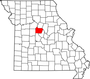 Map of Missouri highlighting Cooper County | |
| Villages | ||
| Townships | ||
| Unincorporated communities | ||
This article is issued from Wikipedia. The text is licensed under Creative Commons - Attribution - Sharealike. Additional terms may apply for the media files.