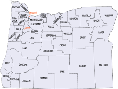
Oregon statistical areas
The statistical areas of the United States of America comprise the metropolitan statistical areas (MSAs),[1] the micropolitan statistical areas (μSAs),[2] and the combined statistical areas (CSAs)[3] currently defined by the United States Office of Management and Budget (OMB).
Most recently on March 6, 2020, the Office of Management and Budget defined 1114 statistical areas for the United States,[4] including 4 combined statistical areas, 8 metropolitan statistical areas, and 12 micropolitan statistical areas in the State of Oregon. The table below shows the recent population of these statistical areas and the 36 counties of Oregon.
Table
The table below describes the 24 United States statistical areas and 36 counties of the State of Oregon with the following information:[5]
- The combined statistical area (CSA) as designated by the OMB.[4]
- The CSA population according to 2019 US Census Bureau population estimates.[6]
- The core based statistical area (CBSA)[7] as designated by the OMB.[4]
- The CBSA population according to 2019 US Census Bureau population estimates [6]
- The county name
- The county population according to 2019 US Census Bureau population estimates [6]
| Combined Statistical Area | 2019 Population | Core Based Statistical Area | 2019 Population | County | 2019 Population |
|---|---|---|---|---|---|
| Portland-Vancouver-Salem, OR-WA CSA | 3,259,710 2,648,793 |
Portland-Vancouver-Hillsboro, OR-WA MSA | 2,492,412 1,992,088 |
Multnomah County, Oregon | 812,855 |
| Washington County, Oregon | 601,592 | ||||
| Clark County, Washington | 488,241 | ||||
| Clackamas County, Oregon | 418,187 | ||||
| Yamhill County, Oregon | 107,100 | ||||
| Columbia County, Oregon | 52,354 | ||||
| Skamania County, Washington | 12,083 | ||||
| Salem, OR MSA | 433,903 | Marion County, Oregon | 347,818 | ||
| Polk County, Oregon | 86,085 | ||||
| Albany-Lebanon, OR MSA | 129,749 | Linn County, Oregon | 129,749 | ||
| Longview, WA MSA | 110,593 | Cowlitz County, Washington | 110,593 | ||
| Corvallis, OR MSA | 93,053 | Benton County, Oregon | 93,053 | ||
| none | Eugene-Springfield, OR MSA | 382,067 | Lane County, Oregon | 382,067 | |
| Medford-Grants Pass, OR CSA | 308,431 | Medford, OR MSA | 220,994 | Jackson County, Oregon | 220,994 |
| Grants Pass, OR μSA | 87,487 | Josephine County, Oregon | 87,487 | ||
| Bend-Prineville, OR CSA | 222,096 | Bend, OR MSA | 197,692 | Deschutes County, Oregon | 197,692 |
| Prineville, OR μSA | 24,404 | Crook County, Oregon | 24,404 | ||
| none | Roseburg, OR μSA | 110,980 | Douglas County, Oregon | 110,980 | |
| Hermiston-Pendleton, OR μSA | 89,553 | Umatilla County, Oregon | 77,950 | ||
| Morrow County, Oregon | 11,603 | ||||
| Klamath Falls, OR μSA | 68,238 | Klamath County, Oregon | 68,238 | ||
| Coos Bay, OR μSA | 64,487 | Coos County, Oregon | 64,487 | ||
| Newport, OR μSA | 49,962 | Lincoln County, Oregon | 49,962 | ||
| Astoria, OR μSA | 40,224 | Clatsop County, Oregon | 40,244 | ||
| Boise City-Mountain Home-Ontario, ID-OR CSA | 831,235 30,571 |
Boise City-Nampa, ID MSA | 749,202 | Ada County, Idaho | 481,587 |
| Canyon County, Idaho | 229,849 | ||||
| Gem County, Idaho | 18,112 | ||||
| Owyhee County, Idaho | 11,823 | ||||
| Boise County, Idaho | 7,831 | ||||
| Ontario, OR-ID μSA | 54,522 30,571 |
Malheur County, Oregon | 30,571 | ||
| Payette County, Idaho | 23,951 | ||||
| Mountain Home, ID μSA | 27,511 | Elmore County, Idaho | 27,511 | ||
| none | La Grande, OR μSA | 26,835 | Union County, Oregon | 26,835 | |
| The Dalles, OR μSA | 26,682 | Wasco County, Oregon | 26,682 | ||
| Hood River, OR μSA | 23,382 | Hood River County, Oregon | 23,382 | ||
| Brookings, OR μSA | 22,925 | Curry County, Oregon | 22,925 | ||
| none | Tillamook County, Oregon | 27,036 | |||
| Jefferson County, Oregon | 24,658 | ||||
| Baker County, Oregon | 16,124 | ||||
| Lake County, Oregon | 7,869 | ||||
| Harney County, Oregon | 7,393 | ||||
| Wallowa County, Oregon | 7,208 | ||||
| Grant County, Oregon | 7,199 | ||||
| Gilliam County, Oregon | 1,912 | ||||
| Sherman County, Oregon | 1,780 | ||||
| Wheeler County, Oregon | 1,332 | ||||
| State of Oregon | 4,217,737 | ||||
See also
- State of Oregon
- Outline of Oregon
- Index of Oregon-related articles
- Geography of Oregon
- Demographics of Oregon
- Oregon counties
- Oregon statistical areas
- Geography of Oregon
- Demographics of the United States
- United States Census Bureau
- List of US states and territories by population
- List of US cities by population
- Cities and metropolitan areas of the US
- United States Office of Management and Budget
- Statistical Area
- Primary Statistical Area
- List of the 725 PSAs
- Combined Statistical Area
- List of the 128 CSAs
- Core Based Statistical Area
- List of the 955 CBSAs
- Metropolitan Statistical Area
- List of the 374 MSAs
- List of US MSAs by GDP
- Micropolitan Statistical Area
- List of the 581 μSAs
- Primary Statistical Area
- Statistical Area
- United States Census Bureau
References
- The United States Office of Management and Budget (OMB) defines a metropolitan statistical area (MSA) as a core based statistical area having at least one urbanized area of 50,000 or more population, plus adjacent territory that has a high degree of social and economic integration with the core as measured by commuting ties.
- The United States Office of Management and Budget (OMB) defines a micropolitan statistical area (μSA) as a core based statistical area having at least one urban cluster of at least 10,000 but less than 50,000 population, plus adjacent territory that has a high degree of social and economic integration with the core as measured by commuting ties.
- The United States Office of Management and Budget (OMB) defines a combined statistical area (CSA) as an aggregate of adjacent core based statistical areas that are linked by commuting ties.
- OMB BULLETIN NO. 20-01: Revised Delineations of Metropolitan Statistical Areas, Micropolitan Statistical Areas, and Combined Statistical Areas, and Guidance on Uses of the Delineations of These Areas Archived 2020-04-20 at the Wayback Machine. Office of Management and Budget. March 6, 2020.
- An out-of-state area and its population are displayed in green. An area that extends into more than one state is displayed in teal. A teal population number over a black population number show the total population versus the in-state population.
- "Annual Estimates of the Resident Population for Counties in the United States: April 1, 2010 to July 1, 2019". United States Census Bureau, Population Division. April 2020. Retrieved April 9, 2020.
- The United States Office of Management and Budget (OMB) defines a core based statistical area as one or more adjacent counties or county-equivalents having at least one urban cluster of at least 10,000 population, plus adjacent territory that has a high degree of social and economic integration with the core as measured by commuting ties. The core based statistical areas comprise the metropolitan statistical areas and the micropolitan statistical areas.