Ontario Highway 49
King's Highway 49, commonly referred to as Highway 49, is a provincially maintained highway in the Canadian province of Ontario. The 5.8-kilometre (3.6 mi) highway travels from the Quinte Skyway to the northern boundary of the Tyendinaga Mohawk Territory south of Marysville. Most of the highway is situated within the Tyendinaga reserve.
| ||||||||||
|---|---|---|---|---|---|---|---|---|---|---|
| Route information | ||||||||||
| Maintained by the Ministry of Transportation of Ontario | ||||||||||
| Length | 5.8 km[1] (3.6 mi) | |||||||||
| History | 1936–1961 York County February 1965[2]–present Picton–Marysville | |||||||||
| Major junctions | ||||||||||
| South end | Quinte Skyway to Prince Edward County | |||||||||
| North end | North limit of Tyendinaga Mohawk Territory | |||||||||
| Highway system | ||||||||||
| ||||||||||
Route description
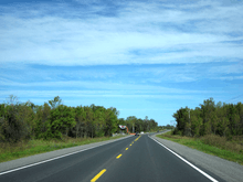
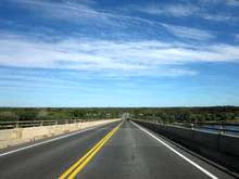
Highway 49 is a short highway that connects the county maintained roads that once formed a part of it. The province transferred the majority of the route to Prince Edward County and Hastings County in 1998. However, the Quinte Skyway (constructed in 1967)[3] and the section lying within the Tyendinaga Mohawk Territory remain under provincial jurisdiction. At the southern end of the skyway, the route connects with Prince Edward County Road 49, which continues south to Picton, as well as County Road 15 and County Road 35. At the northern end of the skyway, the highway intersects the former Highway 2, which travels east to the town of Deseronto. From there it travels north to the northern edge of the Tyendinaga Mohawk Territory,[4] and from there approximately 2.1 kilometres (1.3 mi) as part of (unsigned) Hastings County Road 15 to the Highway 401 interchange, where the road is still signed as Highway 49 (and, incorrectly, Hastings County Road 49).
History
Prior to 1998, the road's southern terminus was at Highway 33 in Picton, while the northern terminus was at Highway 401 Marysville.[5]
Old Highway 49
A road in York Region serving Kleinburg was designated as provincial Highway 49 from 1936 until 1961, after which York County assumed the highway. Today it is known as Nashville Road (York Regional Road 49).
Major intersections
The following table lists the major junctions along Highway 49, as noted by the Ministry of Transportation of Ontario.[6]
| Division | Location | km[7] | mi | Destinations | Notes |
|---|---|---|---|---|---|
| Picton | −20.2 | −12.6 | Decommissioned January 1, 1998[5]; now Prince Edward County Road 49 | ||
| Prince Edward County | 0.0 | 0.0 | County Road 15 | Southern end of Quinte Skyway | |
| Hastings | Tyendinaga Mohawk Territory | 1.0 | 0.62 | County Road 16 – Deseronto | Northern end of Quinte Skyway; southern end of Tyendinaga Mohawk Territory |
| 2.4 | 1.5 | Dundas Street – Deseronto York Street | Southern end of former Highway 2 concurrency | ||
| 5.8 | 3.6 | Tyendinaga Township Road L31 | Northern end of Tyendinaga Mohawk Territory; end of Highway 49 | ||
| Marysville | 6.9 | 4.3 | Old Highway 2 | Northern end of former Highway 2 concurrency; section decommissioned January 1, 1998[5]; now Hastings County Road 15 | |
| 7.9 | 4.9 | Section decommissioned January 1, 1998[5]; now Hastings County Road 15 | |||
1.000 mi = 1.609 km; 1.000 km = 0.621 mi
| |||||
References
- Ministry of Transportation of Ontario (2007). "Annual Average Daily Traffic (AADT) counts". Archived from the original on July 6, 2011. Retrieved September 9, 2011.
- A.A.D.T. Traffic Volumes 1955–1969 And Traffic Collision Data 1967–1969. Ontario Department of Highways. 1970. p. 118.
- "Study Overview". Hwy 49 Bay of Quinte Skyway Bridge Rehabilitation. Retrieved 13 July 2018.
- Ontario Back Road Atlas (Map). Cartography by MapArt. Peter Heiler. 2010. pp. 14, 20–21, 27. § D–E51. ISBN 978-1-55198-226-7.
- Highway Transfers List - "Who Does What" (Report). Ministry of Transportation of Ontario. June 20, 2001. pp. 6, 13.
- Ministry of Transportation of Ontario (2008). "Annual Average Daily Traffic (AADT) counts". Archived from the original on July 6, 2011. Retrieved February 8, 2012.
- Ministry of Transportation of Ontario (2008). "Annual Average Daily Traffic (AADT) counts". Archived from the original on July 6, 2011. Retrieved February 8, 2012.
External links
| |||||||||||
| |||||||||||
| |||||||||||
| |||||||||||

