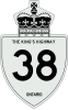
Ontario Highway 38
King's Highway 38, commonly referred to as Highway 38, was a provincially maintained highway in the Canadian province of Ontario. The road connects highways 2 and 401 in Kingston with Highway 7 west of Perth.
| ||||||||||
|---|---|---|---|---|---|---|---|---|---|---|
| Route information | ||||||||||
| Maintained by City of Kingston, South Frontenac and Central Frontenac Township | ||||||||||
| Length | 67.0 km[1] (41.6 mi) | |||||||||
| Existed | April 25, 1934[2]–January 1, 1998[1] | |||||||||
| Major junctions | ||||||||||
| South end | ||||||||||
| North end | ||||||||||
| Location | ||||||||||
| Counties | Frontenac | |||||||||
| Major cities | Kingston | |||||||||
| Towns | South Frontenac Township, Central Frontenac Township | |||||||||
| Villages | Hartington, Harrowsmith, Verona, Godfrey, Parham, Tichborne, Sharbot Lake | |||||||||
| Highway system | ||||||||||
| ||||||||||
Highway 38 was designated in 1934 and remained relatively unchanged throughout its existence aside from some minor diversions. At the beginning of 1998, the entire highway was transferred to the City of Kingston and the municipalities of Frontenac County.
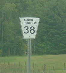
Since Frontenac County does not have a county highway network,[3] it is now maintained by South Frontenac Township and Central Frontenac Township as well as the City of Kingston. South Frontenac Township refers to its portion of the former highway as Township Road 38, in the manner of reference for all of its numbered township highways.[4]
Route description
Highway 38 was a north–south route located within Frontenac County in eastern Ontario. The southern terminus was at Highway 2 in the northwest corner of suburban Kingston, while the northern terminus was at Highway 7 north of the town of Sharbot Lake, approximately 36 kilometres (22 mi) west of Perth. The road which carried Highway 38 continues south of Highway 401 as Gardiners Road.[5]
There are several communities located along former Highway 38 between Kingston and Sharbot Lake, including (from south to north) Harrowsmith, Verona, Godfrey and Parham. The western side of Frontenac Provincial Park is accessible from the route near Verona and Godfrey.[5]
History
Highway 38 was first assumed by the Department of Highways on April 25, 1934, connecting Highway 2 with Highway 7.[2] While the department initially constructed some diversions to improve the alignment of the route, which followed several concession roads north of Cataraqui, the route remained relatively unchanged from when it was established to when it was decommissioned.
One notable change, made soon before the highway was to be downloaded to the municipalities, was to rebuild the section in Kingston Township between Highway 2 and Highway 401, as a four-lane road on an alignment one block east of the former highway (now Midland Avenue, Kingston), in order to connect directly with Gardiners Road (formerly Frontenac County Road 6). This section (which serves an industrial park) was the first to be decertified as a provincial highway, truncating the road to run between highways 7 and 401 only. The current "Kingston 38" county road - style designation ends at Highway 2 although Gardiners Road as a local street continues to Bath Road (Highway 33).
On January 1, 1998, the entirety of Highway 38 was transferred to the County of Frontenac and the City of Kingston.[1]
Major intersections
The following table lists the major junctions along Highway 38, as noted by the Ministry of Transportation of Ontario.[6] The entire route was located in Frontenac County.
| Location | km[6] | mi | Destinations | Notes | |
|---|---|---|---|---|---|
| Kingston | 0.0 | 0.0 | |||
| Central Frontenac | 67.0 | 41.6 | |||
| 1.000 mi = 1.609 km; 1.000 km = 0.621 mi | |||||
See Also
References
- Highway Transfers List - "Who Does What" (Report). Ministry of Transportation of Ontario. June 20, 2001. p. 5.
- "Appendix 4 - Schedule of Assumptions and Reversions". Annual Report (Report). Department of Highways. March 31, 1935. p. 119.
- Roads and Bridges, County of Frontenac, retrieved 2019-04-23
- The Corporation of the Township of South Frontenac, By-Law 2000-01 (PDF), retrieved 2019-06-30
- Mapart (2010). Ontario Back Road Atlas (Map). Peter Heiler Ltd. pp. 36, 48. § X54–D55. ISBN 978-1-55198-226-7.
- Ministry of Transportation of Ontario (2008). "Annual Average Daily Traffic (AADT) counts". Archived from the original on July 6, 2011. Retrieved February 13, 2012.
External links
| |||||||||||
| |||||||||||
| |||||||||||
| |||||||||||

