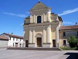
Olmeneta
Olmeneta (Cremunés: Ulmenéeda) is a comune (municipality) in the Province of Cremona in the Italian region Lombardy, located about 70 kilometres (43 mi) southeast of Milan and about 11 kilometres (7 mi) north of Cremona.
Olmeneta | |
|---|---|
| Comune di Olmeneta | |
 | |
Location of Olmeneta 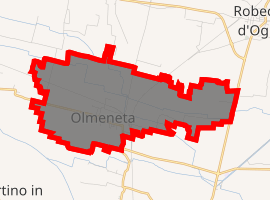
| |
 Olmeneta Location of Olmeneta in Italy 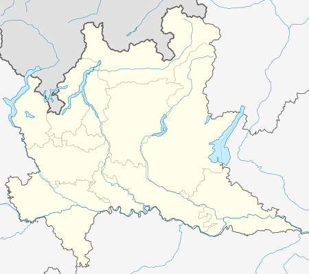 Olmeneta Olmeneta (Lombardy) | |
| Coordinates: 45°14′N 10°1′E | |
| Country | Italy |
| Region | Lombardy |
| Province | Cremona (CR) |
| Government | |
| • Mayor | Renzo Felisari |
| Area | |
| • Total | 9.2 km2 (3.6 sq mi) |
| Elevation | 55 m (180 ft) |
| Population (28 February 2017)[2] | |
| • Total | 947 |
| • Density | 100/km2 (270/sq mi) |
| Time zone | UTC+1 (CET) |
| • Summer (DST) | UTC+2 (CEST) |
| Postal code | 26010 |
| Dialing code | 0372 |
Olmeneta borders the following municipalities: Casalbuttano ed Uniti, Castelverde, Corte de' Cortesi con Cignone, Pozzaglio ed Uniti, Robecco d'Oglio.
Transportation
Olmeneta has a railway station which is a junction of the lines Brescia–Cremona and Treviglio–Cremona.
gollark: Suuuuuure.
gollark: *evil*
gollark: + JS
gollark: + Scala
gollark: + Python.
References
- "Superficie di Comuni Province e Regioni italiane al 9 ottobre 2011". Istat. Retrieved 16 March 2019.
- All demographics and other statistics: Italian statistical institute Istat.
This article is issued from Wikipedia. The text is licensed under Creative Commons - Attribution - Sharealike. Additional terms may apply for the media files.