Nyírtelek
Nyírtelek is a town in Szabolcs-Szatmár-Bereg county, in the Northern Great Plain region of eastern Hungary.
Nyírtelek | |
|---|---|
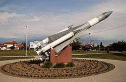 Defence Memorial Park, Nyírtelek | |
 Flag  Coat of arms | |
 Nyírtelek | |
| Coordinates: 48°01′N 21°38′E | |
| Country | |
| County | Szabolcs-Szatmár-Bereg |
| Area | |
| • Total | 67.92 km2 (26.22 sq mi) |
| Population (2005) | |
| • Total | 7,114 |
| • Density | 105.21/km2 (272.5/sq mi) |
| Time zone | UTC+1 (CET) |
| • Summer (DST) | UTC+2 (CEST) |
| Postal code | 4461 |
| Area code(s) | 42 |
History
The town was separated from Nyíregyháza and became an independent settlement in January 1952 under the name Sőrekút. It was renamed to its current name still in that year, in November 1952.
Geography
It covers an area of 67.92 km2 (26 sq mi) and has a population of 7114 people (2005).


gollark: You're limited to the tiny ecosystems of your TV's vendor.
gollark: See, that's also a problem.
gollark: I think in some smart TVs basic UI features like "switch input" are part of the fragile "smart" bit.
gollark: Also apparently subsidized by data gathering.
gollark: Because the built-in thing is insecure and bad.
This article is issued from Wikipedia. The text is licensed under Creative Commons - Attribution - Sharealike. Additional terms may apply for the media files.