Magosliget
Magosliget is a village in Szabolcs-Szatmár-Bereg county, in the Northern Great Plain region of eastern Hungary.
Magosliget | |
|---|---|
| Country | |
| County | Szabolcs-Szatmár-Bereg |
| Area | |
| • Total | 5.18 km2 (2.00 sq mi) |
| Population (2015) | |
| • Total | 315[1] |
| • Density | 60.8/km2 (157/sq mi) |
| Time zone | UTC+1 (CET) |
| • Summer (DST) | UTC+2 (CEST) |
| Postal code | 4953 |
| Area code(s) | 44 |
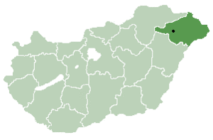
Location of Szabolcs-Szatmar-Bereg county in Hungary
Geography
It covers an area of 5.18 km2 (2 sq mi) and has a population of 315 people (2015).[1]
gollark: https://tenor.com/view/limite-math-y-axis-x-axis-calculus-gif-14990687
gollark: Denied.
gollark: Caption?
gollark: https://tenor.com/view/justin-timberlake-dance-cool-mirrors-gif-12222188↓ Tux1 navigating GTech™ Containment Site 11
gollark: ↑ Tux1 visualization
References
- Gazetteer of Hungary, 1 January 2015. Hungarian Central Statistical Office. 3 September 2015


This article is issued from Wikipedia. The text is licensed under Creative Commons - Attribution - Sharealike. Additional terms may apply for the media files.