Nosegawa, Nara
Nosegawa (野迫川村, Nosegawa-mura) is a village located in Yoshino District, Nara Prefecture, Japan.
Nosegawa 野迫川村 | |
|---|---|
Village | |
 Flag  Emblem | |
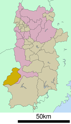 Location of Nosegawa in Nara Prefecture | |
 Nosegawa Location in Japan | |
| Coordinates: 34°10′N 135°38′E | |
| Country | Japan |
| Region | Kansai |
| Prefecture | Nara Prefecture |
| District | Yoshino |
| Area | |
| • Total | 155.03 km2 (59.86 sq mi) |
| Population (October 1, 2016) | |
| • Total | 424 |
| • Density | 2.7/km2 (7.1/sq mi) |
| Symbols | |
| • Tree | Betula platyphylla |
| • Flower | Rhododendron |
| • Bird | Japanese bush-warbler |
| Time zone | UTC+9 (JST) |
| City hall address | 648-0305 |
| Website | www |
As of October 1, 2016, the village has an estimated population of 424. The total area is 155.03 km2.
Geography
Located in southwestern portion of Nara Prefecture, it is surrounded by the Kii Mountain Range. Mount Natsumushi (1349 m) and Mount Arakami (1260 m) are two major mountains in Nosegawa. Many rivers, such as the Iketsu River, run through the village and are eventually united by the Totsukawa River which flows to the Pacific Ocean.
Surrounding municipalities
- Nara Prefecture
- Gojō
- Totsukawa
- Wakayama Prefecture
Education
- Primary Schools
- Nosegawa Elementary School
- Junior High Schools
- Nosegawa Junior High School
gollark: How? It's at a fixed depth or whatever on my screen.
gollark: Am I supposed to be seeing something other than an abstract color squiggle?
gollark: It's obviously the letters Qih81e.
gollark: Kind of worrying given that they're going into self-driving cars and stuff.
gollark: According to my calculations, you see, that would be bad.
External links

- Nosegawa official website (in Japanese)
Nara (capital) | ||
| Core city | ||
| Cities | ||
| Districts | ||
| Authority control |
|
|---|
This article is issued from Wikipedia. The text is licensed under Creative Commons - Attribution - Sharealike. Additional terms may apply for the media files.