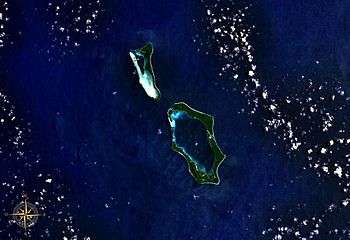
Nissan Island
Nissan Island (also Green Island[1] or Sir Charles Hardy Island[2]) is the largest of the Green Islands of Papua New Guinea. It is located at 4°30′S 154°13′E, about 200 km east of Rabaul on New Britain and about 200 km north-west of Bougainville. The island is administered under Nissan Rural LLG in the Autonomous Region of Bougainville.[3]

History
British and American whaling vessels visited the island in the nineteenth century for food, water and wood. The first on record was the Addison in 1837, and the last was Palmetto in 1881.[4]
During World War II, in the Battle of the Green Islands, US and New Zealand troops recaptured several islands from heavily outnumbered Imperial Japanese forces. The New Zealand 3rd Division landed on Nissan Island on 15 February 1944[5] as part of the Solomon Islands campaign to isolate the Japanese stronghold at Rabaul. Shortly after the landings two airfields were constructed on the island.[6] Richard Nixon was a supply officer on the base, and is remembered as being popular with the indigenous inhabitants. There was also a PT boat base on another island nearby. There were approximately 17,000 allied troops on the island at that time. Much of the indigenous population was removed to Guadacanal for about seven to nine months. After that time the front line had moved closer to Japan and the island was no longer needed in the war effort.
See also
References
- Rottman, Gordon L. (2001). World War II Pacific Island Guide: A Geo-military Study. Greenwood Publishing Group. p. 175. Retrieved 25 April 2018.
- Woodman, Joseph Edmund; Peary, Robert Edwin, eds. (1919). The World Flat-globe and International Geographical History of the World. New York: World Flat-Globe Corporation. p. 153.
- United Nations in Papua New Guinea (2018). "Papua New Guinea Village Coordinates Lookup". Humanitarian Data Exchange. 1.31.9.
- Langdon, Robert (1984), Where the whalers went: an index to the Pacific ports and islands visited by American whalers (and some other vessels) in the 19th century, Canberra, Pacific Manuscripts Bureau, p.186. ISBN 086784471X
- Gillespie, Oliver A. (1952). "The Official History of New Zealand in the Second World War, 1939–1945: IV: The Capture of the Green Islands". Retrieved 2006-10-18.
- Milton W. Bush Jr. "GREEN ISLAND IN WORLD WAR II 1944: BASE No.7". Retrieved 23 November 2011.