Nera Plateau
The Nera Plateau (Russian: Нерское плоскогорье, Yakut: Ньара хаптал хайалаах сирэ) is a mountain plateau in the southeastern Sakha Republic (Oymyakon District) and the northwestern end of Magadan Oblast (Susumansky District), Far Eastern Federal District, Russia.
| Nera Plateau | |
|---|---|
| Ньара хаптал хайалаах сирэ Нерское плоскогорье | |
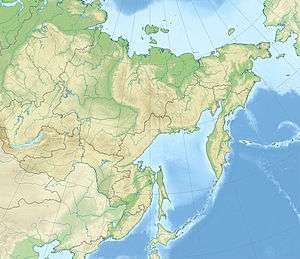
 Location in the Far Eastern Federal District, Russia | |
| Highest point | |
| Peak | Khulamryn |
| Elevation | 2,077 m (6,814 ft) |
| Dimensions | |
| Length | 130 km (81 mi) |
| Width | 70 km (43 mi) |
| Area | 20,000 km2 (7,700 sq mi) |
| Geography | |
| Country | Russia |
| Federal subject | Sakha Republic, Magadan Oblast |
| Range coordinates | 64°0′N 145°30′E |
| Parent range | East Siberian System |
| Geology | |
| Age of rock | Triassic and Jurassic |
| Type of rock | Siltstone, shale and sandstone |
The Ust-Nera - Magadan tract of the R504 Kolyma Highway crosses the plateau from northwest to southeast.[1] There are gold placers in certain spots of the Nera Plateau.[2]
Geography
The Nera Plateau is at the source area of the Nera River, a tributary of the Indigirka. Other rivers on it are the Ayan Yuryakh, one of the rivers that form the Kolyma, and the Byoryolyokh, an Ayan Yuryakh tributary. The plateau is limited by ranges of the Chersky mountain system to the northeast, the Upper Kolyma Highlands to the southeast and the Tas-Kystabyt (Sarychev Range) to the southwest.[2]
The average elevations of the plateau surface lie between 700 metres (2,300 ft) and 1,500 metres (4,900 ft). The highest summit is Khulamryn (гора Хуламрин), a 2,077 feet (633 m) high peak.[3]
Flora
The plateau is in an area dominated by permafrost.[3] There are sparse larch forests on the plateau and thickets of dwarf cedar and alder up to elevations from 1,100 metres (3,600 ft) to 1,200 metres (3,900 ft), above which there is only mountain tundra.[2]
See also
References
- Google Earth
- Нерское плоскогорье — Great Soviet Encyclopedia in 30 vols. / Ch. ed. A.M. Prokhorov - 3rd ed. - M, 1969–1978
- Great Russian Encyclopedia