National Register of Historic Places listings in East Providence, Rhode Island
This is a list of Registered Historic Places in East Providence, Rhode Island.
Bristol | Kent | Newport | Providence | Washington |
- This National Park Service list is complete through NPS recent listings posted August 14, 2020.[1]
| [2] | Name on the Register[3] | Image | Date listed[4] | Location | City or town | Description |
|---|---|---|---|---|---|---|
| 1 | Bicknell-Armington Lightning Splitter House | 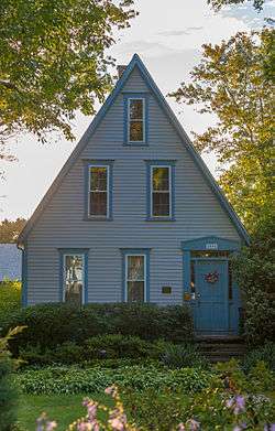 Bicknell-Armington Lightning Splitter House |
November 28, 1980 (#80000085) |
3591 Pawtucket Ave. 41°46′36″N 71°21′47″W |
East Providence | |
| 2 | Boston and Providence Railroad Bridge | 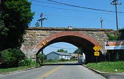 Boston and Providence Railroad Bridge |
November 28, 1980 (#80000086) |
Spans the Ten Mile River 41°50′05″N 71°21′45″W |
East Providence | |
| 3 | Bridgham Farm | 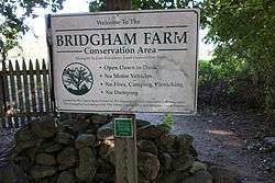 Bridgham Farm |
November 28, 1980 (#80000087) |
120, 148, 150, and 160 Pleasant St. 41°50′13″N 71°20′38″W |
East Providence | |
| 4 | Carpenter, Lakeside, and Springvale Cemeteries | 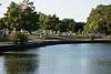 Carpenter, Lakeside, and Springvale Cemeteries |
November 28, 1980 (#80000091) |
Newman and Pawtucket Aves. 41°50′33″N 71°21′09″W |
East Providence | |
| 5 | Crescent Park Looff Carousel | 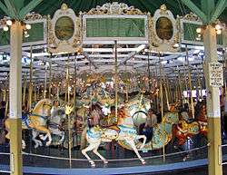 Crescent Park Looff Carousel |
April 21, 1976 (#76000045) |
Riverside Park 41°45′24″N 71°21′34″W |
East Providence | Restored 1895 carousel features some of Charles I.D. Looff's finest workmanship |
| 6 | Nathaniel Daggett House |  Nathaniel Daggett House |
November 28, 1980 (#80000092) |
74 Roger Williams Ave. 41°50′16″N 71°21′46″W |
East Providence | |
| 7 | James Dennis House |  James Dennis House |
November 28, 1980 (#80000095) |
3120 Pawtucket Ave. 41°47′21″N 71°21′53″W |
East Providence | |
| 8 | District 6 Schoolhouse |  District 6 Schoolhouse |
November 28, 1980 (#80000096) |
347 Willett Ave 41°46′23″N 71°21′19″W |
East Providence | |
| 9 | Elm Tree Plat Historic District | 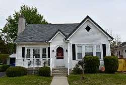 Elm Tree Plat Historic District |
November 19, 2015 (#15000829) |
Charlotte & Elinora Sts., Fenner, Harvey & Willett Aves. 41°46′13″N 71°21′10″W |
East Providence | |
| 10 | Little Neck Cemetery | 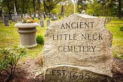 Little Neck Cemetery |
November 28, 1980 (#80000100) |
Off Read St. 41°45′59″N 71°21′18″W |
East Providence | |
| 11 | Newman Cemetery | 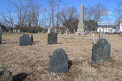 Newman Cemetery |
November 28, 1980 (#80000002) |
Newman and Pawtucket Aves. 41°50′22″N 71°21′04″W |
East Providence | |
| 12 | Newman Congregational Church | 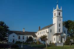 Newman Congregational Church |
November 28, 1980 (#80000003) |
100 Newman Ave. 41°50′28″N 71°21′03″W |
East Providence | |
| 13 | Oddfellow's Hall | 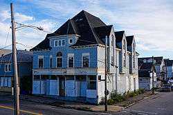 Oddfellow's Hall |
November 28, 1980 (#80000004) |
63-67 Warren Ave. 41°49′01″N 71°22′56″W |
East Providence | |
| 14 | Phillipsdale Historic District | Phillipsdale Historic District |
September 15, 2011 (#11000675) |
Roughly bounded by Seekonk River, Roger Williams Ave. & Ruth Ave. 41°50′52″N 71°21′55″W |
East Providence | |
| 15 | Pomham Rocks Light Station | 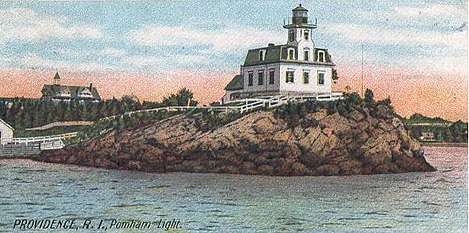 Pomham Rocks Light Station |
July 9, 1979 (#79000001) |
Riverside Rd. 41°46′40″N 71°22′13″W |
East Providence | |
| 16 | Richmond Paper Company Mill Complex | 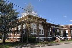 Richmond Paper Company Mill Complex |
November 1, 2006 (#06000974) |
310 Bourne Ave. 41°50′31″N 71°22′14″W |
East Providence | |
| 17 | Rose Land Park Plat Historic District | 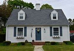 Rose Land Park Plat Historic District |
November 19, 2015 (#15000830) |
Florence St., Roseland Ct., Dartmouth, Princeton & Willett Aves. 41°46′09″N 71°21′03″W |
East Providence | |
| 18 | Rumford Chemical Works and Mill House Historic District | 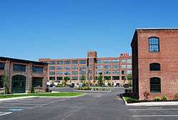 Rumford Chemical Works and Mill House Historic District |
November 28, 1980 (#80000007) |
N. Broadway, Newman, and Greenwood Aves. 41°50′22″N 71°21′16″W |
East Providence | |
| 19 | Rumford Historic District | 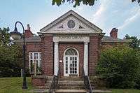 Rumford Historic District |
November 28, 1980 (#80000008) |
Pleasant St. and Greenwood and Pawtucket Aves 41°49′50″N 71°20′55″W |
East Providence | |
| 20 | St. Mary's Episcopal Church | 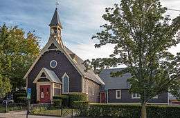 St. Mary's Episcopal Church |
November 28, 1980 (#80000009) |
83 Warren Ave. 41°49′01″N 71°22′54″W |
East Providence | |
| 21 | Squantum Association | 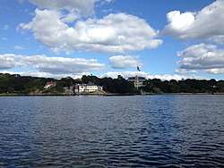 Squantum Association |
November 28, 1980 (#80000010) |
947 Veterans Memorial Parkway 41°47′24″N 71°22′25″W |
East Providence | |
| 22 | Phillip Walker House | 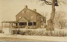 Phillip Walker House |
June 24, 1972 (#72000006) |
432 W. Massasoit Ave. 41°49′49″N 71°21′50″W |
East Providence | |
| 23 | Whitcomb Farm | 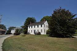 Whitcomb Farm |
November 28, 1980 (#80000013) |
36 Willett Ave. 41°46′37″N 71°21′45″W |
East Providence | |
| 24 | World War I Memorial | 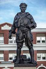 World War I Memorial |
October 19, 2001 (#01000466) |
Junction of Taunton Ave. and Weldon St. 41°49′10″N 71°22′15″W |
East Providence |
See also
References
- "National Register of Historic Places: Weekly List Actions". National Park Service, United States Department of the Interior. Retrieved on August 14, 2020.
- Numbers represent an ordering by significant words. Various colorings, defined here, differentiate National Historic Landmarks and historic districts from other NRHP buildings, structures, sites or objects.
- "National Register Information System". National Register of Historic Places. National Park Service. March 13, 2009.
- The eight-digit number below each date is the number assigned to each location in the National Register Information System database, which can be viewed by clicking the number.
| Topics | _(extra_close)_(US48).svg.png) | ||||||||||
|---|---|---|---|---|---|---|---|---|---|---|---|
| Lists by county | |||||||||||
| Lists by city |
| ||||||||||
| |||||||||||
This article is issued from Wikipedia. The text is licensed under Creative Commons - Attribution - Sharealike. Additional terms may apply for the media files.