National Register of Historic Places listings in Ballard County, Kentucky
This is a list of the National Register of Historic Places listings in Ballard County, Kentucky.
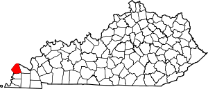
Location of Ballard County in Kentucky
It is intended to be a complete list of the properties on the National Register of Historic Places in Ballard County, Kentucky, United States. The locations of National Register properties for which the latitude and longitude coordinates are included below, may be seen in a map.[1]
There are 6 properties listed on the National Register in the county.
- This National Park Service list is complete through NPS recent listings posted August 14, 2020.[2]
Current listings
| [3] | Name on the Register | Image | Date listed[4] | Location | City or town | Description |
|---|---|---|---|---|---|---|
| 1 | Ballard County Courthouse | 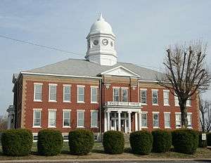 Ballard County Courthouse |
February 27, 1980 (#80001480) |
4th and Court Sts. 36°57′55″N 89°05′19″W |
Wickliffe | |
| 2 | Barlow House | 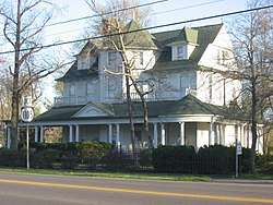 Barlow House |
November 21, 1991 (#91001663) |
Junction of Broadway and S. 5th St. 37°03′05″N 89°02′44″W |
Barlow | |
| 3 | Dr. David Polk Juett Farmstead |  Dr. David Polk Juett Farmstead |
August 14, 1998 (#98000936) |
Blandville-Hinkleville Rd. 36°57′23″N 88°57′19″W |
Blandville | |
| 4 | Andrew Lovelace Jr. House | 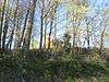 Andrew Lovelace Jr. House |
January 3, 1978 (#78001296) |
West of Lovelaceville off U.S. Route 62 36°57′59″N 88°50′06″W |
Lovelaceville | |
| 5 | Trimble House | 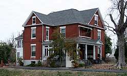 Trimble House |
January 4, 2007 (#06001203) |
725 N. 4th St. 36°58′16″N 89°05′19″W |
Wickliffe | |
| 6 | Wickliffe Site 15 BA 4 | 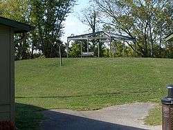 Wickliffe Site 15 BA 4 |
December 8, 1984 (#84000789) |
U.S. Routes 51/62 at Wickliffe Mounds State Historic Site[5] 36°58′16″N 89°05′34″W |
Wickliffe |
gollark: I just realized that osmarkslisp™ never actually uses the `NoParse` thing I defined in it and apparently nobody noticed.
gollark: Well, I think most cases would be fine with 1 to 3 bracketless arguments.
gollark: Technically, that was two other values, but hħhħhh.
gollark: So `<bee apio` = `(bee apio)`.
gollark: And similar things for other brackets.
See also
| Wikimedia Commons has media related to National Register of Historic Places in Ballard County, Kentucky. |
References
- The latitude and longitude information provided in this table was derived originally from the National Register Information System, which has been found to be fairly accurate for about 99% of listings. Some locations in this table may have been corrected to current GPS standards.
- "National Register of Historic Places: Weekly List Actions". National Park Service, United States Department of the Interior. Retrieved on August 14, 2020.
- Numbers represent an ordering by significant words. Various colorings, defined here, differentiate National Historic Landmarks and historic districts from other NRHP buildings, structures, sites or objects.
- The eight-digit number below each date is the number assigned to each location in the National Register Information System database, which can be viewed by clicking the number.
- Location derived from Wickliffe Mounds, Kentucky Department of Parks, 2012. Accessed 2012-11-01. The NRIS lists the site as "Address Restricted".
| Topics | |
|---|---|
| Lists by state |
|
| Lists by insular areas | |
| Lists by associated state | |
| Other areas | |
| Related | |
| |
Municipalities and communities of Ballard County, Kentucky, United States | ||
|---|---|---|
| Cities | Location of Ballard County, Kentucky | |
| CDPs | ||
| Unincorporated communities | ||
This article is issued from Wikipedia. The text is licensed under Creative Commons - Attribution - Sharealike. Additional terms may apply for the media files.