Naho Rawa Rural LLG
Naho Rawa Rural LLG is a local-level government (LLG) of Madang Province, Papua New Guinea.[1][2]
Naho Rawa Rural LLG | |
|---|---|
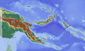
 Naho Rawa Rural LLG Location within Papua New Guinea | |
| Coordinates: 5.829757°S 145.934781°E | |
| Country | Papua New Guinea |
| Province | Madang Province |
| Time zone | UTC+10 (AEST) |
Wards
- 01. Gurumbo
- 02. Mungoui
- 03. Ranara
- 04. Boro
- 05. Tauta
- 06. Barim
- 07. Goiro
- 08. Niningo
- 09. Numbaiya
- 10. Gomumu
- 11. Saranga
- 12. Serengo
- 13. Kikipe
- 14. Wamunde
- 15. Wari
- 16. Butemu
- 17. Durukopo
- 18. Senei
- 19. Gumbarami
- 20. Sewe
gollark: If it was then... construct a polynomial through all those points?
gollark: I'm pretty sure it's not, though.
gollark: Why not deploy worry mirror technology?
gollark: The only *acceptable* way to describe colors is as a list of tuples of (inbound light frequency, photon count).
gollark: If you look at a color space diagram you might just go "wow, those are just undifferentiated cyans, why would I care about those", but this is merely due to your monitor bad.
References
- "Census Figures by Wards - Momase Region". www.nso.gov.pg. 2011 National Population and Housing Census: Ward Population Profile. Port Moresby: National Statistical Office, Papua New Guinea. 2014.
- "Final Figures". www.nso.gov.pg. 2011 National Population and Housing Census: Ward Population Profile. Port Moresby: National Statistical Office, Papua New Guinea. 2014.
- OCHA FISS (2018). "Papua New Guinea administrative level 0, 1, 2, and 3 population statistics and gazetteer". Humanitarian Data Exchange. 1.31.9.
- United Nations in Papua New Guinea (2018). "Papua New Guinea Village Coordinates Lookup". Humanitarian Data Exchange. 1.31.9.
This article is issued from Wikipedia. The text is licensed under Creative Commons - Attribution - Sharealike. Additional terms may apply for the media files.