Bundi Rural LLG
Bundi Rural LLG is a local-level government (LLG) of Madang Province, Papua New Guinea.[1][2]
Bundi Rural LLG | |
|---|---|
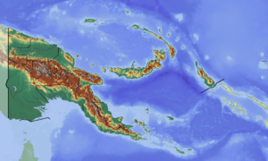
 Bundi Rural LLG Location within Papua New Guinea | |
| Coordinates: 5.747503°S 145.235028°E | |
| Country | Papua New Guinea |
| Province | Madang Province |
| Time zone | UTC+10 (AEST) |
Wards
- 01. Bundi-kara
- 02. Snopass
- 03. Bononi
- 04. Imuri
- 05. Gobug-Agu
- 06. Yandara
- 07. Kindaukevi
- 08. Karamuke
- 09. Marum
- 10. Mokinangi
- 11. Guyebi
- 12. Emegari
- 13. Kobum
- 14. Mondinongra
- 15. Pupuneri
- 16. Biom
- 17. Promisi
- 18. Brahman
- 19. Tauya
- 20. Safi
- 21. Pendiva
- 22. Krumbukari
gollark: I checked, heavserver does in fact have :esolime:.
gollark: I think heavserver has it?
gollark: What happened to them?
gollark: ... where is Tux1?!
gollark: This <:bonk:787781477328355378> emoji was truly one of my best innovations.
References
- "Census Figures by Wards - Momase Region". www.nso.gov.pg. 2011 National Population and Housing Census: Ward Population Profile. Port Moresby: National Statistical Office, Papua New Guinea. 2014.
- "Final Figures". www.nso.gov.pg. 2011 National Population and Housing Census: Ward Population Profile. Port Moresby: National Statistical Office, Papua New Guinea. 2014.
- OCHA FISS (2018). "Papua New Guinea administrative level 0, 1, 2, and 3 population statistics and gazetteer". Humanitarian Data Exchange. 1.31.9.
- United Nations in Papua New Guinea (2018). "Papua New Guinea Village Coordinates Lookup". Humanitarian Data Exchange. 1.31.9.
This article is issued from Wikipedia. The text is licensed under Creative Commons - Attribution - Sharealike. Additional terms may apply for the media files.