Na Khu District
Na Khu (Thai: นาคู, pronounced [nāː kʰūː]) is a district (amphoe) in the eastern part of Kalasin Province, northeastern Thailand.
Na Khu นาคู | |
|---|---|
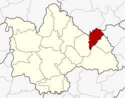 District location in Kalasin Province | |
| Coordinates: 16°46′48″N 104°1′54″E | |
| Country | Thailand |
| Province | Kalasin |
| Seat | Na Khu |
| Area | |
| • Total | 203.0925 km2 (78.4145 sq mi) |
| Population (2005) | |
| • Total | 31,510 |
| • Density | 211.2/km2 (547/sq mi) |
| Time zone | UTC+7 (ICT) |
| Postal code | 46160 |
| Geocode | 4616 |
Geography
Neighboring districts are (from the south clockwise): Khao Wong, Kuchinarai, and Huai Phueng of Kalasin Province; Phu Phan and Tao Ngoi of Sakon Nakhon Province; and Dong Luang of Mukdahan Province.
History
The minor district (king amphoe) was created on 1 April 1995, when it was split off from Khao Wong District.[1]
On 15 May 2007, all 81 minor districts were upgraded to full districts.[2] With publication in the Royal Gazette on 24 August, the upgrade became official.[3]
Administration
The district is divided into five sub-districts (tambons), which are further subdivided into 54 villages (mubans). Na Khu is a township (thesaban tambon) which covers parts of tambon Na Khu. There are a further five tambon administrative organizations (TAO).
| No. | Name | Thai name | Villages | Pop. | |
|---|---|---|---|---|---|
| 1. | Na Khu | นาคู | 13 | 9,799 | |
| 2. | Sai Na Wang | สายนาวัง | 8 | 4,117 | |
| 3. | Non Na Chan | โนนนาจาน | 9 | 4,747 | |
| 4. | Bo Kaeo | บ่อแก้ว | 14 | 8,780 | |
| 5. | Phu Laen Chang | ภูแล่นช้าง | 10 | 4,067 |
References
- ประกาศกระทรวงมหาดไทย เรื่อง แบ่งเขตท้องที่อำเภอเขาวง จังหวัดกาฬสินธุ์ ตั้งเป็นกิ่งอำเภอนาคู (PDF). Royal Gazette (in Thai). 112 (Special 9 ง): 69. 22 March 1995.
- แถลงผลการประชุม ครม. ประจำวันที่ 15 พ.ค. 2550 (in Thai). Manager Online.
- พระราชกฤษฎีกาตั้งอำเภอฆ้องชัย...และอำเภอเหล่าเสือโก้ก พ.ศ. ๒๕๕๐ (PDF). Royal Gazette (in Thai). 124 (46 ก): 14–21. 24 August 2007.