Kham Muang District
Kham Muang (Thai: คำม่วง, pronounced [kʰām mûa̯ŋ]) is the northernmost district (amphoe) of Kalasin Province, northeastern Thailand.
Kham Muang คำม่วง | |
|---|---|
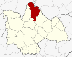 District location in Kalasin Province | |
| Coordinates: 16°55′24″N 103°37′54″E | |
| Country | Thailand |
| Province | Kalasin |
| Seat | Thung Khlong |
| Area | |
| • Total | 621.0 km2 (239.8 sq mi) |
| Population (2005) | |
| • Total | 47,412 |
| • Density | 76.3/km2 (198/sq mi) |
| Time zone | UTC+7 (ICT) |
| Postal code | 46180 |
| Geocode | 4610 |
Geography
Neighboring districts are (from the southeast clockwise): Somdet, Sahatsakhan, Sam Chai of Kalasin Province; Wang Sam Mo of Udon Thani Province; Kut Bak and Phu Phan of Sakon Nakhon Province.
History
The minor district (king amphoe) was established on 1 October 1972, when the three tambons Thung Khlong, Phon, and Sam Ron were split off from Sahatsakhan District.[1] It was upgraded to a full district on 8 September 1976.[2]
Administration
The district is divided into six sub-districts (tambons), which are further subdivided into 70 villages (mubans). There are two townships (thesaban tambons): Kha Muang covers parts of tambon Thung Khlong and Phon parts of the same-named tambon. There are a further six tambon administrative organizations (TAO).
| No. | Name | Thai name | Villages | Pop. | |
|---|---|---|---|---|---|
| 1. | Thung Khlong | ทุ่งคลอง | 12 | 8,696 | |
| 2. | Phon | โพน | 10 | 6,755 | |
| 5. | Din Chi | ดินจี่ | 11 | 6,686 | |
| 6. | Na Bon | นาบอน | 11 | 6,389 | |
| 7. | Na Than | นาทัน | 16 | 13,550 | |
| 9. | Noen Yang | เนินยาง | 10 | 5,336 |
Missing numbers are tambons which now form Sam Chai District.
References
- ประกาศกระทรวงมหาดไทย เรื่อง แบ่งท้องที่อำเภอสหัสขันธ์ จังหวัดกาฬสินธุ์ ตั้งเป็นกิ่งอำเภอคำม่วง (PDF). Royal Gazette (in Thai). 89 (144 ง special): 5. 28 September 1972.
- พระราชกฤษฎีกาตั้งอำเภอเลาขวัญ อำเภอคำม่วง อำเภอพิปูน อำเภอศรีเทพ อำเภอนาแห้ว อำเภอส่องดาว อำเภอควนกาหลง อำเภอค่ายบางระจัน อำเภอบ้านตาขุน และอำเภอกุดจับ พ.ศ. ๒๕๑๙ (PDF). Royal Gazette (in Thai). 93 (109 ก special): 31–34. 8 September 1976.