Myanzi–Kassanda–Bukuya–Kiboga Road
The Myanzi–Kassanda–Bukuya–Kiboga Road is a road in Uganda, connecting the towns of Myanzi, Kassanda and Bukuya in Mubende District, to Kiboga in Kiboga District.
| Myanzi–Kassanda–Bukuya–Kiboga Road | |
|---|---|
| Route information | |
| Length | 39 mi (63 km) |
| Major junctions | |
| South end | Myanzi |
| Kassanda Bukuya | |
| North end | Kiboga |
| Highway system | |
| Roads in Uganda | |
Location
The road starts at Myanzi, on the Mityana–Mubende Road, about 17 kilometres (11 mi) west of Mityana.[1] From there, it takes a northwesterly route to Kassanda, a distance of about 17 kilometres (11 mi).[2] From Kassanda, the road turns northwards to Bukuya, a distance of about 15 kilometres (9 mi).[3] From Bukuya, the road turns northwestwards and continues to Kiboga, a distance of approximately 31 kilometres (19 mi).[4] The coordinates of the road near Kassanda are 0°36'53.0"N, 31°50'09.0"E (Latitude:0.614735; Longitude:31.835822).[5]
Overview
This road is an important transport corridor between Kiboga District and Mubende District.[6] The road is prone to flooding, and when it does, it disrupts travel between the two districts and between those two and Mityana District.[6][7][8]
Upgrading to bitumen
The gravel-surfaced road is under the purview of Uganda National Roads Authority.[6] During his 2016 presidential electoral campaigns, President Yoweri Museveni made a pledge to upgrade this road to class II bitumen standard.[9]
See also
References
- GFC (17 May 2016). "Distance between Mityana, Central Region, Uganda and Myanzi, Central Region, Uganda". Globefeed.com (GFC). Retrieved 17 May 2016.
- GFC (17 May 2016). "Distance between Myanzi, Central Region, Uganda and St. Mbuga Primary School, Kassanda, Central Region, Uganda". Globefeed.com (GFC). Retrieved 17 May 2016.
- GFC (17 May 2016). "Distance between St. Mbuga Primary School, Kassanda, Central Region, Uganda and Bukuya, Central Region, Uganda". Globefeed.com (GFC). Retrieved 17 May 2016.
- GFC (17 May 2016). "Distance between Bukuya, Central Region, Uganda and Kiboga District Local Government, Kampala-Hoima, Kiboga, Central Region, Uganda". Globefeed.com (GFC). Retrieved 17 May 2016.
- Google (17 May 2016). "Location of Myanzi–Kassanda–Bukuya–Kiboga Road" (Map). Google Maps. Google. Retrieved 17 May 2016.
- Kagiri, Luke (19 November 2015). "Floods cut-off Kiboga-Mubende road". New Vision. Kampala. Retrieved 17 May 2016.
- Kagiri, Luke (22 November 2014). "Week-long floods cut off Mubende roads". New Vision. Kampala. Retrieved 17 May 2016.
- Jessica Nabukenya, and Christopher Kisekka (21 April 2016). "Rain cuts off Mubende". Daily Monitor. Kampala. Retrieved 17 May 2016.
- Yoweri Kaguta Museveni (29 January 2016). "I spent the day campaigning in Mityana District". Facebook.com. Retrieved 17 May 2016.
External links
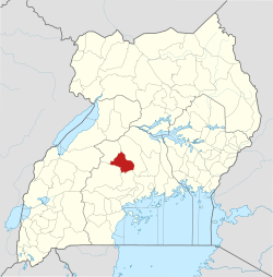
Capital: Kiboga | ||
| Counties and sub-counties |
|  |
| Towns and villages | ||
| Banking | ||
| Health | ||
| Transport | ||
| Notable people | ||
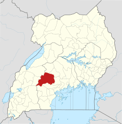
Capital: Mubende | ||
| Parishes |
|  |
| Towns and villages | ||
| Geography |
| |
| Economy |
| |
| Health | ||
| Transport | ||
| Notable landmarks |
| |
| Education | ||
| Notable people | ||