Burnett County, New South Wales

Burnett County, New South Wales is one of the 141 Cadastral divisions of New South Wales.

Burnett
New South Wales
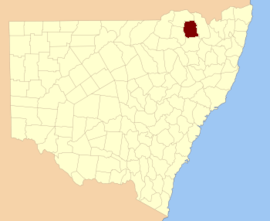
Location in New South Wales
Lands administrative divisions around Burnett:
Stapylton Stapylton Arrawatta
Courallie Burnett Arrawatta
Courallie Murchison Arrawatta

Burnett County was named in honour of James Charles Burnett, surveyor (1815-1854).[1]

Parishes

A full list of parishes found within this county; their current LGA and mapping coordinates to the approximate centre of each location is as follows:

ParishLGACoordinates
AbercrombieGwydir Shire29°12′54″S 150°30′04″E
AdamsGwydir Shire29°39′54″S 150°36′04″E
BalfourGwydir Shire29°37′54″S 150°40′04″E
BaromaGwydir Shire29°09′54″S 150°17′04″E
BledgerGwydir Shire29°27′54″S 150°23′04″E
Blue NobbyInverell Shire29°58′54″S 150°41′04″E
BogamildiGwydir Shire29°22′54″S 150°13′04″E
BoobahGwydir Shire29°31′54″S 150°37′04″E
BoyangaGwydir Shire29°14′54″S 150°20′04″E
BullalaGwydir Shire29°23′54″S 150°20′04″E
BurnettInverell Shire29°33′54″S 150°53′04″E
ClareGwydir Shire29°37′54″S 150°31′04″E
CodringtonGwydir Shire29°16′54″S 150°42′04″E
CoolataiInverell Shire29°11′54″S 150°48′04″E
CoxGwydir Shire29°11′54″S 150°25′04″E
EalesGwydir Shire29°29′54″S 150°19′04″E
EllisGwydir Shire29°01′54″S 150°35′04″E
GillGwydir Shire29°08′54″S 150°27′04″E
GineroiGwydir Shire29°40′54″S 150°31′04″E
GlenalvonGwydir Shire29°21′54″S 150°30′04″E
GoalongaGwydir Shire29°26′54″S 150°30′04″E
GoorabilGwydir Shire29°17′54″S 150°14′04″E
GournamaGwydir Shire29°20′54″S 150°39′04″E
GraginInverell Shire29°31′54″S 150°48′04″E
GravesendGwydir Shire29°32′54″S 150°17′04″E
GugumburraGwydir Shire29°24′54″S 150°38′04″E
GullunguttaGwydir Shire29°29′54″S 150°48′04″E
GunneeInverell Shire29°35′54″S 150°47′04″E
HadleighGwydir Shire29°33′54″S 150°35′04″E
HollingsworthGwydir Shire29°20′54″S 150°45′04″E
KigaGwydir Shire29°05′54″S 150°16′04″E
MandoeGwydir Shire29°10′54″S 150°42′04″E
MitchellGwydir Shire29°02′54″S 150°22′04″E
MonsoonGwydir Shire29°37′54″S 150°16′04″E
MurgoGwydir Shire29°06′54″S 150°21′04″E
MuscleGwydir Shire29°00′54″S 150°28′04″E
MyallaGwydir Shire29°32′54″S 150°45′04″E
Nunga NungaGwydir Shire29°26′54″S 150°15′04″E
OregonGwydir Shire29°28′54″S 150°27′04″E
OttleyGwydir Shire29°20′54″S 150°50′04″E
ParkhurstInverell Shire29°07′54″S 150°47′04″E
PepperboxGwydir Shire29°11′54″S 150°37′04″E
Rocky HoleGwydir Shire29°17′54″S 150°24′04″E
RussellInverell Shire29°20′54″S 150°55′04″E
SingapooraGwydir Shire29°41′54″S 150°24′04″E
StackGwydir Shire29°12′54″S 150°16′04″E
StanleyGwydir Shire29°23′54″S 150°30′04″E
StephensonGwydir Shire29°09′54″S 150°33′04″E
StrathmoreGwydir Shire29°22′54″S 150°25′04″E
StuartGwydir Shire29°18′54″S 150°30′04″E
TackinbriGwydir Shire29°01′54″S 150°17′04″E
Tullin TullaGwydir Shire29°04′54″S 150°21′04″E
VicarsGwydir Shire29°29′54″S 150°30′04″E
WarialdaGwydir Shire29°32′54″S 150°34′04″E
YagobeGwydir Shire29°29′54″S 150°14′04″E
YallaroiGwydir Shire29°04′54″S 150°32′04″E
YallaroiGwydir Shire29°04′54″S 150°29′04″E
gollark: LyricLy, you have 44100ish seconds.
gollark: I'm sure you'd like to think so.
gollark: There is one, yes.
gollark: They're highly lasery.
gollark: Via orbital criticism lasers.

References

  1. "Burnett County". Geographical Names Register (GNR) of NSW. Geographical Names Board of New South Wales.
This article is issued from Wikipedia. The text is licensed under Creative Commons - Attribution - Sharealike. Additional terms may apply for the media files.