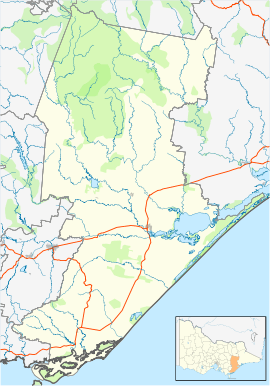
Munro, Victoria
Munro is a town in Victoria, Australia, located on Munro - Stockdale Road, just north of the Princes Highway eleven kilometres east of Straford, in the Shire of Wellington.
| Munro Victoria | |
|---|---|
 Munro | |
| Coordinates | 37°54′S 147°11′E |
| Population | 143 (2016 census)[1] |
| Postcode(s) | 3862 |
| Location | |
| LGA(s) | Shire of Wellington |
| State electorate(s) | Gippsland East |
| Federal Division(s) | Gippsland |
At the most recent national census, Munro had 143 citizens living within its district.[2] The town has no commercial businesses but it does have a St Mary's Anglican Church.
Transport
Munro is a closed station located on the Bairnsdale railway line railway line in Victoria, Australia. It was 233 km from Southern Cross station.
The passenger platform was abolished by mid 1975, along with the goods platform.[3]
gollark: New operators?
gollark: Hmm, Go 2 generics actually seem fairly okay from briefly skimming this?
gollark: Great! Now to hope they fix all the other issues!
gollark: Oh, Go 2 actually exists now?
gollark: It is not some sort of difficult technical challenge to add generics.
References
- Australian Bureau of Statistics (27 June 2017). "Munro (State Suburb)". 2016 Census QuickStats. Retrieved 19 March 2018.

- http://www.censusdata.abs.gov.au/census_services/getproduct/census/2016/quickstat/SSC21818?opendocument
- "Works & Safeworking". Newsrail. Australian Railway Historical Society. August 1975. p. 179.
This article is issued from Wikipedia. The text is licensed under Creative Commons - Attribution - Sharealike. Additional terms may apply for the media files.