Mulberry, Oklahoma
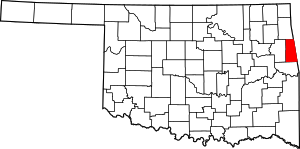
Mulberry is a census-designated place (CDP) in Adair County, Oklahoma, United States. The population was 138 at the 2010 census.[3]
Mulberry, Oklahoma | |
|---|---|
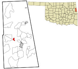
 Location within Adair County and the state of Oklahoma | |
| Coordinates: 35°51′45″N 94°42′0″W | |
| Country | United States |
| State | Oklahoma |
| County | Adair |
| Area | |
| • Total | 0.9 sq mi (2.4 km2) |
| • Land | 0.9 sq mi (2.4 km2) |
| • Water | 0.0 sq mi (0.0 km2) |
| Elevation | 1,000 ft (300 m) |
| Population (2010) | |
| • Total | 138 |
| • Density | 148/sq mi (57.0/km2) |
| Time zone | UTC-6 (Central (CST)) |
| • Summer (DST) | UTC-5 (CDT) |
| FIPS code | 40-49825[1] |
| GNIS feature ID | 2584385[2] |
Geography
Mulberry is located at 35°51′45″N 94°42′0″W, along Oklahoma State Highway 51. It is 6 miles (10 km) northwest of Stilwell, the county seat, and 18 miles (29 km) east of Tahlequah in Cherokee County.
According to the United States Census Bureau, the CDP has a total area of 0.93 square miles (2.4 km2).[3]
gollark: I generally want less, but pandemic control is somewhat hard to do outside of governments with how things currently work.
gollark: Arguably, people infecting you with viruses infringes on your rights.
gollark: Fine. I think it's reasonable to have governments remove some rights in some situations, then.
gollark: I think that if governments had actually been competent with initial containment, it wouldn't have been necessary to do lockdowns; given that they were useless, they were probably the least bad solution.
gollark: I was mostly complaining about their specific reasoning there (it is not very sensible, inasmuch as basically no possible bad event is *guaranteed* but ignoring the possibility of them is quite bad for you), but I don't agree with the rest of what they said either, so thing.
References
- "U.S. Census website". United States Census Bureau. Retrieved 2008-01-31.
- "US Board on Geographic Names". United States Geological Survey. 2007-10-25. Retrieved 2008-01-31.
- "Geographic Identifiers: 2010 Demographic Profile Data (G001): Mulberry CDP, Oklahoma". U.S. Census Bureau, American Factfinder. Archived from the original on February 12, 2020. Retrieved July 12, 2013.
This article is issued from Wikipedia. The text is licensed under Creative Commons - Attribution - Sharealike. Additional terms may apply for the media files.
