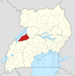
Mparo, Hoima
Mparo is a village in Hoima District, in the Western Region of Uganda. It is the location of the "Mparo Tombs", one of the Royal burial sites of the Bunyoro Kingdom.[1]
Mparo | |
|---|---|
Village | |
 Mparo Location in Uganda | |
| Coordinates: 01°26′08″N 31°23′56″E | |
| Country | |
| Region | Western Region |
| Sub-region | Bunyoro sub-region |
| District | Hoima District |
| Time zone | UTC+3 (EAT) |
Location
Mparo is located approximately 4 kilometres (2 mi), by road, northeast of downtown Hoima, along the Hoima-Masindi Road.[1][2] The coordinates of Mparo, Hoima are:01°26'08.0"N, 31°23'56.0"E (Latitude:1.435556; Longitude:31.398889).[3]
Overview
The Mparo Tombs are a historical cultural site. The royal tombs are the burial site of Omukama (‘King’) Chwa II Kabalega who reigned in Bunyoro Kitara in the late 19th century. He was exiled to the Seychelles in 1899, by the British colonialists. Inside are his spears, bowls, throne and other personal effects on display above the actual place of interment. Also buried at the site is the late Sir Tito Winyi IV, father of the current Omukama, Rukirabasaija Agutamba Solomon Gafabusa Iguru I.[1][2]
See also
References
- LPC (10 August 2017). "Mparo Tombs: Historic site in Hoima". Lonelyplanet.com (LPC). Retrieved 10 August 2017.
- Mugerwa, Francis (3 August 2012). "Inside Bunyoro's historical Mparo royal tombs". Daily Monitor. Kampala. Retrieved 10 August 2017.
- Google (11 August 2017). "Location of Mparo, Hoima District, Uganda" (Map). Google Maps. Google. Retrieved 11 August 2017.
