Mountain, North Dakota
Mountain is a town in Thingvalla Township, Pembina County, North Dakota, United States. The population was 92 at the 2010 census.[5] Mountain was founded in 1884.
Mountain, North Dakota | |
|---|---|
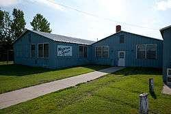 Mountain Chalet in Mountain | |
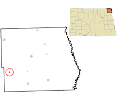 Location of Mountain, North Dakota | |
| Coordinates: 48°41′2″N 97°51′54″W | |
| Country | United States |
| State | North Dakota |
| County | Pembina |
| Founded | 1884 |
| Area | |
| • Total | 0.12 sq mi (0.32 km2) |
| • Land | 0.12 sq mi (0.32 km2) |
| • Water | 0.00 sq mi (0.00 km2) |
| Elevation | 1,066 ft (325 m) |
| Population | |
| • Total | 92 |
| • Estimate (2019)[3] | 82 |
| • Density | 672.13/sq mi (258.57/km2) |
| Time zone | UTC-6 (Central (CST)) |
| • Summer (DST) | UTC-5 (CDT) |
| ZIP code | 58262 |
| Area code(s) | 701 |
| FIPS code | 38-54740 |
| GNIS feature ID | 1030309[4] |
The community was the destination of many Icelandic immigrants who began arriving about 1878. Geir Haarde, a former prime minister of Iceland, attended the Annual 2 August Celebration in 2007. During his visit, town officials told Haarde about a goal to raise $1.3 million for a new community center. The government of Iceland has since donated $75,000 towards the center.[6]
History
Mountain was laid out in 1884.[7] The city was named on account of its lofty elevation.[8] A post office called Mountain has been in operation since 1881.[9]
Geography
Mountain is located at 48°41′2″N 97°51′54″W
According to the United States Census Bureau, the city has a total area of 0.14 square miles (0.36 km2), all of it land.[10]
Demographics
| Historical population | |||
|---|---|---|---|
| Census | Pop. | %± | |
| 1940 | 205 | — | |
| 1950 | 219 | 6.8% | |
| 1960 | 218 | −0.5% | |
| 1970 | 146 | −33.0% | |
| 1980 | 156 | 6.8% | |
| 1990 | 134 | −14.1% | |
| 2000 | 133 | −0.7% | |
| 2010 | 92 | −30.8% | |
| Est. 2019 | 82 | [3] | −10.9% |
| U.S. Decennial Census[11] 2018 Estimate[12] | |||
2010 census
As of the census[2] of 2010, there were 92 people, 30 households, and 14 families residing in the city. The population density was 657.1 inhabitants per square mile (253.7/km2). There were 42 housing units at an average density of 300.0 per square mile (115.8/km2). The racial makeup of the city was 97.8% White, 1.1% Native American, and 1.1% from other races. Hispanic or Latino of any race were 1.1% of the population.
There were 30 households, of which 13.3% had children under the age of 18 living with them, 30.0% were married couples living together, 10.0% had a female householder with no husband present, 6.7% had a male householder with no wife present, and 53.3% were non-families. 46.7% of all households were made up of individuals, and 13.3% had someone living alone who was 65 years of age or older. The average household size was 1.73 and the average family size was 2.43.
The median age in the city was 65.5 years. 6.5% of residents were under the age of 18; 3.4% were between the ages of 18 and 24; 13% were from 25 to 44; 26% were from 45 to 64; and 51.1% were 65 years of age or older. The gender makeup of the city was 44.6% male and 55.4% female.
2000 census
As of the census of 2000, there were 133 people, 43 households, and 26 families residing in the city. The population density was 978.4 people per square mile (366.8/km2). There were 55 housing units at an average density of 404.6 per square mile (151.7/km2). The racial makeup of the city was 99.25% White and 0.75% Native American.
There were 43 households, out of which 25.6% had children under the age of 18 living with them, 44.2% were married couples living together, 16.3% had a female householder with no husband present, and 39.5% were non-families. 37.2% of all households were made up of individuals, and 27.9% had someone living alone who was 65 years of age or older. The average household size was 2.16 and the average family size was 2.81.
In the city, the population was spread out, with 16.5% under the age of 18, 5.3% from 18 to 24, 12.8% from 25 to 44, 18.0% from 45 to 64, and 47.4% who were 65 years of age or older. The median age was 64 years. For every 100 females, there were 87.3 males. For every 100 females age 18 and over, there were 76.2 males.
The median income for a household in the city was $23,750, and the median income for a family was $31,875. Males had a median income of $28,750 versus $25,625 for females. The per capita income for the city was $12,237. There were 17.9% of families and 19.8% of the population living below the poverty line, including 47.1% of under eighteens and 14.3% of those over 64.
Notable people
- Einar Jonasson (1887-1935), politician in Manitoba, was born in the area but moved with his family to Canada in 1888.
Notes
- "2019 U.S. Gazetteer Files". United States Census Bureau. Retrieved July 27, 2020.
- "U.S. Census website". United States Census Bureau. Retrieved June 14, 2012.
- "Population and Housing Unit Estimates". United States Census Bureau. May 24, 2020. Retrieved May 27, 2020.
- "US Board on Geographic Names". United States Geological Survey. October 25, 2007. Retrieved January 31, 2008.
- "2010 Census Redistricting Data (Public Law 94-171) Summary File". American FactFinder. United States Census Bureau. Archived from the original on April 11, 2015. Retrieved May 2, 2011.
- "Foreign Aid". KansasCity.com. Retrieved January 20, 2008.
- "Cities". County of Pembina, North Dakota. Archived from the original on September 17, 2015. Retrieved 26 October 2015.
- Federal Writers' Project (1938). The WPA Guide to North Dakota: The Northern Prairie State. WPA. p. 227. ISBN 978-1-59534-232-4.
- "Pembina County". Jim Forte Postal History. Retrieved October 25, 2015.
- "US Gazetteer files 2010". United States Census Bureau. Archived from the original on January 25, 2012. Retrieved June 14, 2012.
- United States Census Bureau. "Census of Population and Housing". Retrieved August 30, 2013.
- "Population Estimates". United States Census Bureau. Retrieved September 20, 2019.
External links
- The Dakota Icelanders Project
- MountainND.com
- August the Deuce Celebration
- Thingvalla Lutheran Church Memorial
- Pioneer Women's Histories : Mountain from the Digital Horizons website
Municipalities and communities of Pembina County, North Dakota, United States | ||
|---|---|---|
| Cities | 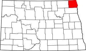 Map of North Dakota highlighting Pembina County | |
| Townships | ||
| Unincorporated communities | ||