Mount Burr, South Australia
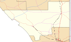
Mount Burr is a small town in the south-east of South Australia, about 10 km east of Millicent and about 55 km north-west of Mount Gambier. At the 2006 census, Mount Burr had a population of 380.[2]
| Mount Burr South Australia | |||||||||||||||
|---|---|---|---|---|---|---|---|---|---|---|---|---|---|---|---|
 Mount Burr | |||||||||||||||
| Coordinates | 37°32′29″S 140°27′26″E[1] | ||||||||||||||
| Population | 380 (2006 census)[2] | ||||||||||||||
| Established | 1844 | ||||||||||||||
| Postcode(s) | 5279 | ||||||||||||||
| Elevation | 67 m (220 ft) | ||||||||||||||
| Time zone | ACST (UTC+9:30) | ||||||||||||||
| • Summer (DST) | ACST (UTC+10:30) | ||||||||||||||
| Location | 55 km (34 mi) NE of Mount Gambier | ||||||||||||||
| LGA(s) | Wattle Range Council | ||||||||||||||
| State electorate(s) | MacKillop | ||||||||||||||
| Federal Division(s) | Barker | ||||||||||||||
| |||||||||||||||
| Footnotes | Adjoining localities[1] | ||||||||||||||
Geography
The town is named after a local mountain called Mount Burr ; it measures 240 metres (790 feet) tall and is one of 15 dormant or extinct volcanoes within the Limestone Coast. The mountain of Mount Burr is home to the SES 8 television transmitter, which is responsible for transmitting WIN, Seven SA, Ten SA, SBS and ABC to households across the South East of SA and Western Victoria.
History
Mount Burr was home to a large timber mill. The mill was the first of its kind in the region, built in 1931. It was considered a turning point for industry on the Limestone Coast. Unfortunately in late 2000 the timber mill closed leaving many employees unemployed.
The mountain was named by Governor George Grey after George Dominicus Burr, a surveyor and Professor of Mathematics at Sandhurst Military College. His son, Thomas Burr, a surveyor, accompanied Governor Grey on the expedition in 1844.
7 May 1844: At about 2pm we made the top of a range, the principal summit of which his Excellency has done me the honour to call after my father. The Mount Burr range is about 1600 feet above the level of the sea...
— Mr Thos. Burr, Dep Surv.-Gen., [3]
The historic Mount Graham Homestead is listed on the South Australian Heritage Register.[4]
See also
- Burr (disambiguation)
Notes and references
- "Search results for "Nangwarry. LOCB' with the following datasets selected – 'Suburbs and Localities', 'Counties", "Government Towns", "Local Government Areas", "SA Government Regions", "Railways", 'Hundreds', 'Roads' and 'Gazetteer'". Location SA Map Viewer. South Australian Government. Retrieved 27 February 2018.
- Australian Bureau of Statistics (25 October 2007). "Mount Burr (L) (Urban Centre/Locality)". 2006 Census QuickStats. Retrieved 11 October 2011.
- Burr, Thos.; Stanley, Lord. "Account of Governor G. Grey's Exploratory Journey along the South-Eastern Sea-board of South Australia". The Journal of the Royal Geographical Society of London. John Murray, Albemarle Street, London. 15 (1845): 160–184. Retrieved 20 February 2015.
- "Mount Graham Homestead". South Australian Heritage Register. Department of Environment, Water and Natural Resources. Retrieved 26 August 2016.