Mohgaon
Mohgaon is a town and a nagar parishad in Chhindwara district in the Indian state of Madhya Pradesh.
Mohgaon | |
|---|---|
city | |
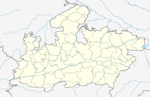
 Mohgaon Location in Madhya Pradesh, India  Mohgaon Mohgaon (India) | |
| Coordinates: 21.65°N 78.72°E | |
| Country | |
| State | Madhya Pradesh |
| District | Chhindwara |
| Elevation | 366 m (1,201 ft) |
| Population (2001) | |
| • Total | 9,890 |
| Languages | |
| • Official | Hindi |
| Time zone | UTC+5:30 (IST) |
| ISO 3166 code | IN-MP |
| Vehicle registration | MP |
Geography
Mohgaon is located at 21.65°N 78.72°E.[1] It has an average elevation of 366 metres (1,200 feet).
Demographics
As of 2001 India census,[2] Mohgaon had a population of 9,890. Males constitute 52% of the population and females 48%. Mohgaon has an average literacy rate of 62%, higher than the national average of 59.5%: male literacy is 69%, and female literacy is 55%. In Mohgaon, 14% of the population is under 6 years of age.
The population of the town in divided into the social hierarchy based on profession. For example, the tax collectors from the British era are second behind the Brahmins and like to be identified by their last name Mohgaonkar.
gollark: Finally someone gets it!
gollark: Clearly we should try to hasten that day by creating and spreading such memes.
gollark: Ah.
gollark: Do you actually know... Hebrew, or whatever that is?
gollark: I feel like I'm missing some sort of cultural context here.
References
- Falling Rain Genomics, Inc - Mohgaon
- "Census of India 2001: Data from the 2001 Census, including cities, villages and towns (Provisional)". Census Commission of India. Archived from the original on 16 June 2004. Retrieved 1 November 2008.
This article is issued from Wikipedia. The text is licensed under Creative Commons - Attribution - Sharealike. Additional terms may apply for the media files.