Bamhani
Bamhani is a town and nagar panchayat in the Mandla district in the state of Madhya Pradesh, India. Bamhani is commonly known as Bamhani Banjar because of the river Banjar. It is situated between Mandla and Nainpur broad gauge railway line.bamhani is a city which is centre of many village around them banjar pull is a tourist place of city.Bamhani also famous for Rasmalai of neelam coffee house.
Bamhani Bamhni Banjar | |
|---|---|
City | |
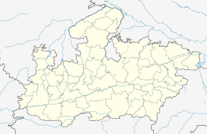
 Bamhani Location in Madhya Pradesh, India  Bamhani Bamhani (India) | |
| Coordinates: 22°28′40″N 80°22′12″E | |
| Country | |
| State | Madhya Pradesh |
| District | Mandla |
| Government | |
| • Kaiser | Nag Akella |
| Population (2001) | |
| • Total | 19,619 |
| Languages | |
| • Official | Hindi |
| Time zone | UTC+5:30 (IST) |
| Telephone code | 07649 |
| ISO 3166 code | IN-MP |
| Vehicle registration | MP51 |
Demographics
As of 2001 India census,[1] Bamhani had a population of 19619. Males constitute 51% of the population and females 49%. 12% of the population is under 6 years of age.
gollark: Anyway, the web platform can be very fast, but people mostly don't care. I'm not sure *why*, since apparently a few hundred ms of load time can reduce customer engagement or something by a few %, which is significant, but apparently people mostly just go for easy in-place solutions like using a CDN rather than actually writing fast webpages.
gollark: Nope, it's mostly static. The SSG is actually a horrible Node script.
gollark: The website.
gollark: What osmarks.tk does is actually just make the site mostly static and have some JS pull in comments and stuff.
gollark: It is not perfect. It looks bad.
References
- "Census of India 2001: Data from the 2001 Census, including cities, villages and towns (Provisional)". Census Commission of India. Archived from the original on 16 June 2004. Retrieved 1 November 2008.
This article is issued from Wikipedia. The text is licensed under Creative Commons - Attribution - Sharealike. Additional terms may apply for the media files.