Manegaon, Madhya Pradesh
Manegaon is a census town in Balaghat district in the Indian state of Madhya Pradesh.
Manegaon | |
|---|---|
city | |
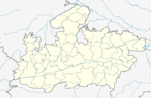
 Manegaon Location in Madhya Pradesh, India  Manegaon Manegaon (India) | |
| Coordinates: 21.85°N 80.25°E | |
| Country | |
| State | Madhya Pradesh |
| District | Balaghat |
| Elevation | 298 m (978 ft) |
| Population (2001) | |
| • Total | 9,174 |
| Languages | |
| • Official | Hindi |
| Time zone | UTC+5:30 (IST) |
| ISO 3166 code | IN-MP |
| Vehicle registration | MP |
Geography
Manegaon is located at 21.85°N 80.25°E.[1] It has an average elevation of 298 metres (977 feet).
Demographics
As of 2001 India census,[2] Manegaon had a population of 9174. Males constitute 52% of the population and females 48%. Manegaon has an average literacy rate of 78%, higher than the national average of 59.5%: male literacy is 83%, and female literacy is 72%. In Manegaon, 10% of the population is under 6 years of age.
gollark: This will hopefully serve as a good example of skynet usage in node and help with integration into other applications.
gollark: <@278889690596376576> Why do links get "confused" in them?
gollark: https://github.com/osmarks/skynet-cliSkynet CLI!
gollark: Skynet-CLI is now mostly working ish.
gollark: PotatOS Brain™ - try it now.
References
- Falling Rain Genomics, Inc - Manegaon
- "Census of India 2001: Data from the 2001 Census, including cities, villages and towns (Provisional)". Census Commission of India. Archived from the original on 16 June 2004. Retrieved 1 November 2008.
This article is issued from Wikipedia. The text is licensed under Creative Commons - Attribution - Sharealike. Additional terms may apply for the media files.