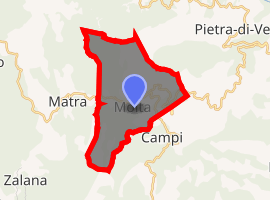
Moïta
Moïta is a commune in the Haute-Corse department of France on the island of Corsica.
Moïta Moita | |
|---|---|
Location of Moïta 
| |
 Moïta  Moïta | |
| Coordinates: 42°16′40″N 9°24′50″E | |
| Country | France |
| Region | Corsica |
| Department | Haute-Corse |
| Arrondissement | Corte |
| Canton | Ghisonaccia |
| Government | |
| • Mayor (2008–2014) | Dominique Gozzi |
| Area 1 | 6 km2 (2 sq mi) |
| Population (2017-01-01)[1] | 75 |
| • Density | 13/km2 (32/sq mi) |
| Time zone | UTC+01:00 (CET) |
| • Summer (DST) | UTC+02:00 (CEST) |
| INSEE/Postal code | 2B161 /20270 |
| Elevation | 220–1,160 m (720–3,810 ft) (avg. 560 m or 1,840 ft) |
| 1 French Land Register data, which excludes lakes, ponds, glaciers > 1 km2 (0.386 sq mi or 247 acres) and river estuaries. | |
Administration
Moïta was the seat of the former canton of Moïta-Verde, which included 13 other communes: Aléria, Ampriani, Campi, Canale-di-Verde, Chiatra, Linguizzetta, Matra, Pianello, Pietra-di-Verde, Tallone, Tox, Zalana and Zuani.[2] Since 2015, it is part of the canton of Ghisonaccia.[3]
Geography
Moïta is 74 kilometres (46 mi) to the south of Bastia and 20 kilometres (12 mi) from the sea. It was part of the ancient parish of Serra. Its territory is split between mountain and plain.
Population
| Year | Pop. | ±% |
|---|---|---|
| 1962 | 215 | — |
| 1968 | 231 | +7.4% |
| 1975 | 200 | −13.4% |
| 1982 | 164 | −18.0% |
| 1990 | 121 | −26.2% |
| 1999 | 76 | −37.2% |
| 2008 | 81 | +6.6% |
gollark: Also no output on other terminals.
gollark: Indeed.
gollark: It does nothing whatsoever.
gollark: Mildly weird question, how come `wall` doesn't work over SSH on my void system?
gollark: ddnscrypt-proxy is also go.
References
- "Populations légales 2017". INSEE. Retrieved 6 January 2020.
- "France, le trésor des régions: Département: Haut-Corse" (in French). Retrieved 2008-05-06..
- "Décret n° 2014-255 du 26 février 2014 portant délimitation des cantons dans le département de la Haute-Corse | Legifrance". Retrieved 2017-05-31.
| Wikimedia Commons has media related to Moïta. |
This article is issued from Wikipedia. The text is licensed under Creative Commons - Attribution - Sharealike. Additional terms may apply for the media files.