Minakami, Gunma
Minakami (みなかみ町, Minakami-machi) is a town located in Gunma Prefecture, Japan. As of February 2015, the town had an estimated population of 19,572, and a population density of 25.1 persons per km². Its total area is 781.08 km². Much of the town is within the borders of Jōshin'etsu-kōgen National Park.
Minakami みなかみ町 | |
|---|---|
Town | |
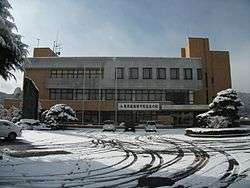 Minakami town hall | |
 Flag  Seal | |
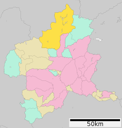 Location of Minakami in Gunma Prefecture | |
 Minakami | |
| Coordinates: 36°40′42.8″N 138°59′56.9″E | |
| Country | Japan |
| Region | Kantō |
| Prefecture | Gunma Prefecture |
| District | Tone |
| Area | |
| • Total | 781.08 km2 (301.58 sq mi) |
| Population (February 2015) | |
| • Total | 19,572 |
| • Density | 25.1/km2 (65/sq mi) |
| Time zone | UTC+9 (Japan Standard Time) |
| - Tree | Siebold’s beech |
| - Flower | Kerria japonica |
| - Bird | Japanese bush-warbler |
| Phone number | 0278-62-2111 |
| Address | 318 Gokan, Minakami-machi, Tone-gun, Gunma-ken 379-1393 |
| Website | http://www.town.minakami.gunma.jp/ |
Geography
Located in northern Gunma, Minakami is bordered by Niigata Prefecture to the north. The town is very mountainous.
- Mountains: Mount Mikuni (1636m), Mount Sennokura (2026m), Mount Ōmine, Mount Tanigawa (1977m), Asahidake (1945m), Mount Hiragatake (2141m)
- Rivers: Tone River, Akatani River
- Lakes: Lake Okutone, Lake Naramata, Lake Fujiwara, Lake Dogen
- Dams: Yagisawa Dam, Naramata Dam, Fujiwara Dam, Aimata Dam, Sudagai Dam
Surrounding municipalities
- Gunma Prefecture
- Niigata Prefecture
- Uonuma
- Minamiuonuma
- Yuzawa
History
The Mikuni Kaidō connecting Takasaki with Niigata from the Heian period onwards passed through area of present-day Minakami, with nine post stations. The area was contested between the competing Uesugi, Takeda and Sanada clans during the Sengoku period. During the Edo period, it was partly under the control of Numata Domain , with the remainder as part of the tenryō holdings within Kōzuke Province administered directly by the Tokugawa shogunate during the Edo period. On April 1, 1889 with the creation of the municipalities system after the Meiji Restoration, Minakami village was established within Tone District, Gunma. It was raised to town status on August 10, 1947. On October 1, 2005, the town of Tsukiyono and the village of Niiharu were merged into Minakami.
Economy
The economy of Minakami is heavily dependent on seasonal tourism to ski resorts and to onsen hot springs.
Education
Elementary schools
- Komemaki Elementary School
- Momono Elementary School
- Tsukiyono Kita Elementary School
- Minakami Elementary School
- Kochi Elementary School
- Fujiwara Elementary School
- Aramaki Elementary School
- Sukawa Elementary School
- Sarugakkyo Elementary School
Middle schools
High schools
Transportation
Railway
- JR East – Jōetsu Shinkansen
- JR East – Jōetsu Line
Highways
- Kan-Etsu Expressway – Tsukiyono IC, Minakami IC
- Japan National Route 17
- Japan National Route 291
International relations

Local attractions
Onsen (Hot Springs)
Minakami has traditionally been an Onsen (hot spring) resort town with 8 major onsen sources and over 40 different bathing facilities to choose from.[1]
Ski Fields
Minakami has a good reputation for good snow conditions. There are 9 ski areas:
- Minakami Houdaigi
- Minakami Kogen
- Minakami Kogen Fujiwara
- Oana
- Tanigawadake Tenjindaira
- Norn Minakami
- Tanigawa Onsen White Valley
- Kanosawa Ski Area
- Akazawa Ski Area
Outdoor
There are many different outdoor pursuits available in Minakami and it has become a very popular destination for outdoor adventure seekers. Some of the outdoor activities include:
- Whitewater rafting (grade 2- 4)
- Canyoning
- Bungy Jumping
- Mountain biking
- Paragliding
- Rock climbing
- Hiking
- Canoeing
- Kayaking
- Snowshoe
- Back country ski & snowboarding
- Caving
Noted people from Minakami
- Kotoinazuma Yoshihiro, sumo wrestler
References
External links
![]()
- Official Website (in Japanese)
Maebashi (capital) | ||
| Core cities |
| |
| Special cities | ||
| Cities | ||
| Districts | ||
| Authority control |
|
|---|