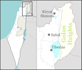
Migdal, Israel
Migdal (Hebrew: מִגְדָּל, lit. Tower) is a town in the Northern District of Israel. It was founded in 1910, and granted local council status in 1949. In 2018 it had a population of 1,941.
Migdal
| |
|---|---|
| Hebrew transcription(s) | |
| • ISO 259 | Migdal |
 Migdal  Migdal | |
| Coordinates: 32°50′20.68″N 35°29′57.46″E | |
| Country | |
| District | Northern |
| Founded | 1910 |
| Government | |
| • Type | Local council (from 1949) |
| • Head of Municipality | Israel Sason Amrosi |
| Area | |
| • Total | 11,395 dunams (11.395 km2 or 4.400 sq mi) |
| Population (2018)[1] | |
| • Total | 1,941 |
| • Density | 170/km2 (440/sq mi) |
| Name meaning | Tower |

Migdal is located near Ginosar, and about 8 km north of Tiberias.[2] It has a shoreline on the Sea of Galilee, including the Tamar, Ilanot and Arbel beaches.
History
Migdal is named after a city from the Second Temple period called "Magdala". The ancient city is believed to have been located on the site of the depopulated village of al-Majdal, which preserved the name.[3]
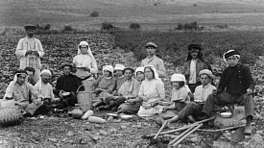
In 1908, a small group of German Catholics who identified the site as the birthplace of Mary Magdalene settled there.[4] They left after a year and the land was bought by Russian Zionists who founded a farm, Ahuzat Moskva (Moscow Estate) in 1910. This settlement was adjacent to the Arab village al-Majdal. A few years later, the land was sold to private investors.[2] An encampment of Gdud HaAvoda workers who built the Tiberias-Rosh Pina road was established there in 1921.[5]
According to a census conducted in 1922 by the British Mandate authorities, Migdal had a population of 51 inhabitants, consisting of 42 Jews and 9 Muslims.[6]
See also
References
- "Population in the Localities 2018" (XLS). Israel Central Bureau of Statistics. 25 August 2019. Retrieved 26 August 2019.
- Hareuveni, Immanuel (2010). Eretz Yisrael Lexicon. Ministry of Education. pp. 558–559.
- Encyclopedia of Zionism and Israel Herzl Press and McGraw-Hill, New York 1971, Volume II, p. 784

